Disclosure : This site contains affiliate links to products. We may receive a commission for purchases made through these links.
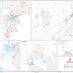
South West Coast Path 4 – South Devon Adventure Atlas

South West Coast Path 4 – South Devon Adventure at 1:25,000 in a series of handy A5 size Adventure Atlases from Geographers` A-Z Map Company with cartography from the Ordnance Survey’s Explorer series. The guide covers the 210 km / 131 mile section of the SWCP National Trail between Plymouth and Lyme Regis and includes a route planner indicating what facilities can be found in locations along and within an easy reach of the path.To see other titles in this series, including the guides to the other four sections of the South West Coast Path, please click on the series link.A-Z Adventure Atlases have cartography of the Ordnance Survey’s Explorer maps and provide plenty of recreational and tourist information, indicating traditional public rights of way paths, including bridleways and byways restricted or open to motorized traffic. Also shown are other routes with public access, including permissive footpaths and bridleways. Special marking indicates National Trails, Long-distance Routes and Recreational Routes, and for cyclists the maps show traffic-free routes and the National Cycle Network. A wide range of symbols highlights locations of special tourist interest: camping and caravanning sites, youth hostels, information offices and visitors’ centres, parking and picnicking places, historic buildings (indicating where appropriate National Trust, English Heritage, or Cadw), sites for various recreational pursuits, country pubs, public toilets, etc. The mapping provides detailed presentation of the topography with contours at 5 or 10m intervals, numerous spot heights and colouring and/or graphics for different types of terrain or vegetation. Additional colouring shows access land, including areas managed by the National Trust, Forestry Commission and Woodland Trust. All the standard information expected of high quality survey mapping at this scale is included: finely graded road network, railway lines with stations, cuttings or embankments, individual isolated buildings, etc. For GPS each page as a 1-km British National Grid. Each atlas has an index which includes geographical features, nature reserves, youth hostels, car parks, etc, and provides additional notes on safety and security when walking, plus QR codes for obtaining by mobile phone information about local weather, danger areas, mountain rescue, map reading, OS National Grid coordinates, etc.

Related Products:
 South West Coast Path 1 – North Devon & Somerset A-Z Adventure Atlas
 South West Coast Path 3 – South Cornwall A-Z Adventure Atlas
 South West Coast Path 5 – Dorset A-Z Adventure Atlas
 South West Coast Path 2 – North Cornwall A-Z Adventure Atlas
 Pennine Way South A-Z Adventure Atlas
 South Downs Way A-Z Adventure Atlas
 Pembrokeshire Coast A-Z Adventure Atlas
 Pennine Way South Adventure Atlas: Edale – Bowes SUPERCEDED
 Yorkshire Dales South Adventure Atlas
 Dorset and South Devon Coast Path – Plymouth to Poole (South West Coast Path Part 3)
 Exmoor & North Devon Coast Path – Minehead to Bude (South West Coast Path Part 1)
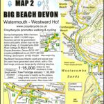 South West Coast Path Map 2 – Big Beach Devon – Watermouth – Westward Ho! Map 58
 Exmoor A-Z Adventure Atlas
 Cotswold Way A-Z Adventure Atlas
 Pennine Way North A-Z Adventure Atlas
 North Downs Way A-Z Adventure Atlas
 Isle of Wight A-Z Adventure Atlas
 South West Coast Path National Trail: Padstow to Falmouth
 Brecon Beacons East A-Z Adventure Atlas
 North York Moors East A-Z Adventure Atlas
 National Three Peaks Adventure Atlas: Ben Nevis, Scafell Pike, Snowdon
 South Devon Coast – Plymouth to Lyme Regis – Classic Walks – South West Coast Path
 Peak District – Dark Peak A-Z Adventure Atlas
 Chichester & The South Downs AA Walker`s Map 20
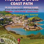
 Exmoor & North Devon Coast Path, South-West-Coast Path Part 1: Minehead to Bude (Trailblazer British Walking Guide): Practical walking guide with 55 large-scale walking maps (1:20,000) and guides to 30 towns and villages – planning, places to stay, places
 England Coast Path – Camber to Folkestone Adventure Map
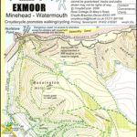 South West Coast Path Map 1 – Exmoor – Minehead – Watermouth Map 57
 South West Coast Path 2 – St Ives to Plymouth Harvey National Trail XT40
 Coastal Pub Walks: South Devon: Walks to amazing pubs along the South West Coast Path
 Somerset & North Devon Coast: Minehead to Bude – Circular walks along the South West Coast Path
 South West Coast Path 1 – Minehead to St Ives Harvey National Trail XT40
 South West Coast Path 3 – Plymouth to Poole Harbour Harvey National Trail XT40
 Cornwall Coast Path – Bude to Plymouth (South West Coast Path Part 2)
 England Coast Path Adventure Map – Minehead to Brean Down
 Walking the South West Coast Path: National Trail From Minehead to South Haven Point
 Norfolk Coast Path and Peddars Way A-Z Adventure Atlas
 West & Central Brecon Beacons AA Walker`s Map 18
Great Britain: A-Z/Ordnance Survey 25K Adventure Atlases
West & Central Brecon Beacons AA Walker`s Map 18
Great Britain: A-Z/Ordnance Survey 25K Adventure Atlases
 North York Moors West AA Walker`s Map 19
 South West Coast Path 1 – Minehead to St Ives Cicerone Map Booklet