Disclosure : This site contains affiliate links to products. We may receive a commission for purchases made through these links.
South Pindos – Tzoumerka ‘“ Peristeri ‘“ Koziakas ‘“ Aygo Anavasi 3.2/4.2

South Pindos: Tzoumerka ‘“ Peristeri ‘“ Koziakas ‘“ Aygo area at 1:50,000 in a series of GPS compatible, waterproof and tear-resistant hiking maps from Anavasi. The map is double-sided: on one side are the peaks of Peristeri, Kakardhitsa and Tzoumerka with the map extending north to Metsovo; on the reverse coverage extend westwards beyond the Koziakas massif. Contour interval is 20m. The map has a UTM grid, plus latitude/longitude crosshairs. The cover provides a list of recommended ascents to the peaks.This title is part of Anavasi’s series of hiking maps of mainland Greece at scales from 1:50,000 to 1:10,000. Contour interval varies depending on the scale, on most maps it is 20m. Relief shading, spot heights, springs, seasonal streams and, in most titles, landscape/land-use variations, e.g. forests, orchards, or vineyards provide additional information on the terrain. Place names are given in both Greek and Latin script.Local footpaths, hostels and mountain huts are clearly marked. For road users intermediate driving distances and petrol stations are shown. Symbols highlight places of interest, including archaeological sites, churches and monasteries, etc. The maps have a UTM grid and margin ticks for latitude and longitude. Map legend and information for hikers include English.

Related Products:
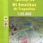 Mt Smolikas – Mt Trapezitsa Anavasi 3.31
 Mt Olympus Anavasi 6.11
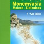 Monemvasia – Maleas – Elafonisos Anavasi 8.9
 Mt Elikon Anavasi 2.6
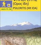 Psiloritis – Mt Ida Anavasi 11.14
Mt Kalidhromo Anavasi 2.2
Psiloritis – Mt Ida Anavasi 11.14
Mt Kalidhromo Anavasi 2.2
 Valia Kalda – Vasilitsa Anavasi 6.4
 White Mountains / Lefka Ori – Sfakia – Pahnes Anavasi 11.11/11.12
 Mt Parnon Anavasi 8.7
 Sikinos Anavasi 10.29
 Zakros – Vai – Sitia Anavasi 11.16
 Cephalonia / Kefalonia – Ithaca Anavasi 9.3
 Skyros Anavasi 10.14
 Kea / Tzia Anavasi 10.41
 Frangokastelo – Plakias Anavasi 11.17
 Tinos Anavasi 10.20
Mt Dhirfis – Mt Xerovouni Anavasi 5.11
Mt Erymanthos Anavasi 8.61
Mt Parnitha Anavasi 1.1
Tinos Anavasi 10.20
Mt Dhirfis – Mt Xerovouni Anavasi 5.11
Mt Erymanthos Anavasi 8.61
Mt Parnitha Anavasi 1.1
 Paxos – Antipaxos Anavasi 9.2
 Rhodes & Symi Anavasi 10.38
 Mainalo – Artemisio – Lyrkeio – Farmakas – Ktenias Anavasi 8.5
 Hydra Anavasi 10.40
 Macedonia Anavasi Regional Map R4
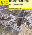 Peloponnese Anavasi Regional Map R2
 Kalymnos – Telendos & Pserimos Anavasi 10.32
 Paros – Antiparos Anavasi 10.23
 Chalki Anavasi 10.33
 Central Greece – Thessaly – Epirus Anavasi Regional Map R3
 Messinia Anavasi 17
 Spetses Anavasi 10.30
 Andros Anavasi 10.21
 Skiathos Anavasi 10.11
 Sifnos Anavasi 10.26
 Fokidha Anavasi 07
 Naxos & Small Cyclades Anavasi 10.28
 Serifos Anavasi 10.25
 Chios – Psara – Inouses Anavasi 10.31
 Amorgos Anavasi 10.27