Disclosure : This site contains affiliate links to products. We may receive a commission for purchases made through these links.
South Lancashire Coalfield 1907
South Lancashire Coalfield in 1907 in a series of reproductions of Ordnance Survey’s famous “Inch to the Mile” maps published in the Alan Godfrey Editions to provide a historical record of England and Wales in the second half of 19th and early 20th century.The map covers the area from Kirkby and Ormskirk eastward to Leigh, and from Adlington and Horwich southward to St Helens. Other locations covered include Abram, Ashton in Makerfield, Atherton, Aughton, Bickerstaffe, Billinge, Blackrod, Burscough Bridge, Culcheth, Dalton, Earlestown, Eccleston, Golborne, Haigh, Hindley, Kenyon, Knowsley, Lathom, Leigh, Lowton, Newton in Makerfield, Parbold, Pemberton, Rainford, Shevington, Skelmersdale, Standish, Upholland, Westhoughton, Westleigh, Wigan. On the reverse is a map of the village of Bryn, including part of Garswood Hall Collieries.About the Alan Godfrey Editions of the OS Inch to the Mile Maps: the maps provide an invaluable overview of a wider area, typically 18 x 12 miles (29 x 19 kms approx.), and offer historical mapping for small towns and villages not covered by the more detailed series for which the Godfrey Editions are better known. On the reverse all the maps have historical notes and most titles also include a more detailed, large scale map of a small town or a village in the area.

Related Products:
 Upper Exe Valley 1907
Isle of Thanet 1893 – 274
South Dartmoor and the South Hams 1909
Devon North: Taw and Torridge Valleys 1907
South East Essex 1884
Redesdale 1866
Kielder 1866
Beachy Head, Newhaven and Eastbourne 1880 – 1903
Sevenoaks and Tonbridge 1893
Norham & Berwick 1864 – 1
Isles of Scilly 1896
Upper Exe Valley 1907
Isle of Thanet 1893 – 274
South Dartmoor and the South Hams 1909
Devon North: Taw and Torridge Valleys 1907
South East Essex 1884
Redesdale 1866
Kielder 1866
Beachy Head, Newhaven and Eastbourne 1880 – 1903
Sevenoaks and Tonbridge 1893
Norham & Berwick 1864 – 1
Isles of Scilly 1896
 Great Britain: Godfrey Editions of Historical Ordnance Survey Inch to a Mile Maps of England & Wales
Montgomery and District 1908
Hertford and St Albans 1898
South Chilterns 1886
Formby, Crosby and District 1896
NE Suffolk 1907 – 176
Holy Island & District 1863 – 4
South West Berkshire 1889
The Cheviot 1901-13 – 5
Holy Island & Seahouses 1898 – 4.1 Coloured Edition
Rothbury Forest 1866-1873
Foulness and Mersea 1904
Penzance and St Ives Bay 1888
Ravenglass and Sellafield 1875
Great Britain: Godfrey Editions of Historical Ordnance Survey Inch to a Mile Maps of England & Wales
Montgomery and District 1908
Hertford and St Albans 1898
South Chilterns 1886
Formby, Crosby and District 1896
NE Suffolk 1907 – 176
Holy Island & District 1863 – 4
South West Berkshire 1889
The Cheviot 1901-13 – 5
Holy Island & Seahouses 1898 – 4.1 Coloured Edition
Rothbury Forest 1866-1873
Foulness and Mersea 1904
Penzance and St Ives Bay 1888
Ravenglass and Sellafield 1875
 Bamfurlong and Bryn Gates 1906
Weston-super-Mare & Highbridge 1897 – 279
Dartmoor 1908
Fareham, Hambledon and Havant 1894
Selsey Bill, Bognor and Worthing 1901
South London 1893
Longtown, Bewcastle and District 1902
Kirkby Lonsdale and District 1870
Bamfurlong and Bryn Gates 1906
Weston-super-Mare & Highbridge 1897 – 279
Dartmoor 1908
Fareham, Hambledon and Havant 1894
Selsey Bill, Bognor and Worthing 1901
South London 1893
Longtown, Bewcastle and District 1902
Kirkby Lonsdale and District 1870
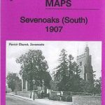 Sevenoaks South 1907
Tunbridge Wells and Ashdown Forest 1894
North Kent Coast 1878
The Solent 1888
Manchester and District 1896
Bristol and District 1912
Horsham, Crawley and St Leonards`s Forest 1901
Sevenoaks South 1907
Tunbridge Wells and Ashdown Forest 1894
North Kent Coast 1878
The Solent 1888
Manchester and District 1896
Bristol and District 1912
Horsham, Crawley and St Leonards`s Forest 1901