Disclosure : This site contains affiliate links to products. We may receive a commission for purchases made through these links.
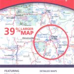
South Carolina Easy-to-Read Rand McNally

South Carolina Easy-to-Read map from Rand McNally, US leading publisher of road maps and street plans, in their extensive series of state maps. Additional panels provide enlargements for: Aiken, Charleston, Charlotte and Vicinity with a more detailed map of the downtown area, Columbia, Greenville, Hilton Head Island, Myrtle Beach – The Grand Strand, Rock Hill and Spartanburg, plus Augusta and Savannah in Georgia.For clarity of road information Rand McNally state maps present the road network on a plain background, with no or little topographic detail. Driving distances are indicated on all principal highways and on many local routes. National or state parks and other protected areas, Indian Reservations and restricted entry military zones are highlighted and symbols indicate campsites, rest areas, various places of interest, etc. Each map shows local administrative boundaries with names of the counties, is indexed and gives geographical coordinates as margin ticks usually at 1ยฐ intervals. Rand McNally state maps are available in two formats: double-sided Easy-to-Read maps with numerous enlargements for cities and/or most visited areas, and laminated Easy-to-Fold maps in a more handy format but with smaller print. TO SEE THE LIST OF RAND McNALLY STATE MAPS PLEASE CLICK ON THE SERIES LINK.

Related Products:
 North Carolina Easy-to-Read Rand McNally
 South Carolina Easy to Fold Rand McNally
 Minnesota Easy-to-Read Rand McNally
 Nebraska Easy-to-Read Rand McNally
 Alabama Easy-to-Read Rand McNally
 Georgia Easy-to-Read Rand McNally
 Kansas Easy-to-Read Rand McNally
 Maine Easy-to-Read Rand McNally
 Mississippi Easy-to-Read Rand McNally
 North Carolina Easy to Fold Rand McNally
 New Hampshire – Vermont Easy-to-Read Rand McNally
 Oregon Easy-to-Read Rand McNally
 Alaska Easy-to-Read Rand McNally
 Indiana Easy-to-Read Rand McNally
 Louisiana Easy-to-Read Rand McNally
Massachusetts Easy-to-Read Rand McNally
Louisiana Easy-to-Read Rand McNally
Massachusetts Easy-to-Read Rand McNally
 Ohio Easy-to-Read Rand McNally
 Michigan Easy-to-Read Rand McNally
 Nevada Easy-to-Read Rand McNally
 New Jersey Easy-to-Read Rand McNally
 West Virginia Easy-to-Read Rand McNally
 Idaho Easy-to-Read Rand McNally
 Washington State Easy-to-Read Rand McNally
 Iowa Easy-to-Read Rand McNally
Colorado Easy-to-Read Rand McNally
Arizona Easy-to-Read Rand McNally
Iowa Easy-to-Read Rand McNally
Colorado Easy-to-Read Rand McNally
Arizona Easy-to-Read Rand McNally
 New York State Easy-to-Read Rand McNally
 Pennsylvania Easy-to-Read Rand McNally
 Illinois Easy-to-Read Rand McNally
Montana – Wyoming Easy-to-Read Rand McNally
Illinois Easy-to-Read Rand McNally
Montana – Wyoming Easy-to-Read Rand McNally
 New Mexico Easy-to-Read Rand McNally
 North Dakota – South Dakota Easy-to-Read Rand McNally
 Kentucky Easy-to-Read Rand McNally
 Wisconsin Easy-to-Read Rand McNally
Tennessee Easy-to-Read Rand McNally
Wisconsin Easy-to-Read Rand McNally
Tennessee Easy-to-Read Rand McNally
 Arkansas Easy-to-Read Rand McNally
 Missouri Easy-to-Read Rand McNally
 Virginia Easy-to-Read Rand McNally
 Connecticut – Rhode Island Easy-to-Read Rand McNally