Disclosure : This site contains affiliate links to products. We may receive a commission for purchases made through these links.
South America: NGS Classic Style Wall Maps
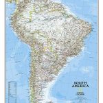
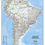
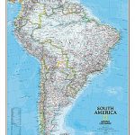
South America wall maps published by National Geographic Society in their classic style of presentation: light beige background with relief shading to show the topography and country borders outlined in contrasting colours. The maps are published in two sizes, (61 x 76cm or 92 x 117cm) each available either on paper or encapsulated.The maps have relief shading to show the topography, with additional graphics for marshlands and salt flats, plus names of various peaks, etc. Many tributaries of the Amazon, the Parana and the Orinoco are named. In the surrounding oceans cold and warm currents are marked.The maps show the network of principal road and rail connections, and indicate numerous local airports. Latitude and longitude lines are drawn at intervals of 5ยฐ.

Related Products:
 South America NGS Classic Wall Map PAPER
 South America NGS Classic Wall Map LARGE PAPER
 South America NGS Classic Wall Map ENCAPSULATED
 South America NGS Classic Wall Map LARGE ENCAPSULATED
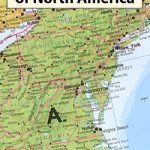
 North America: NGS Classic Style Wall Maps
 World: National Geographic Society Classic Style Political Wall Maps
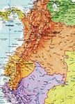
 South America: ITMB Sectional Maps
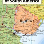 South America: Maps International Political Wall Maps
USA: NGS Classic Style Wall Maps
South America: Maps International Political Wall Maps
USA: NGS Classic Style Wall Maps
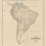
 Stanford`s Library Map of South America (1864) – A3 Wall Map, Paper
Stanford`s Library Map of South America (1864) – A2 Wall Map, Paper
Stanford`s Library Map of South America (1864) – A1 Wall Map, Paper
Stanford`s Library Map of South America (1864) – A4 Wall Map, Canvas
Stanford`s Library Map of South America (1864) – A3 Wall Map, Canvas
Stanford`s Library Map of South America (1864) – A1 Wall Map, Canvas
Stanford`s Library Map of South America (1864) – A3 Wall Map, Paper
Stanford`s Library Map of South America (1864) – A2 Wall Map, Paper
Stanford`s Library Map of South America (1864) – A1 Wall Map, Paper
Stanford`s Library Map of South America (1864) – A4 Wall Map, Canvas
Stanford`s Library Map of South America (1864) – A3 Wall Map, Canvas
Stanford`s Library Map of South America (1864) – A1 Wall Map, Canvas
 South America Global Mapping Political Wall Map PAPER
 South America North ITMB
 Stanford`s Library Map of South America (1864) – Original Size Wall Map, Paper
 Stanford`s Library Map of South America (1864) – Original Size Wall Map, Canvas
Stanford`s Library Map of South America (1864) – A2 Wall Map, Canvas – Print on Demand
Stanford`s Library Map of South America (1864) – Original Size Wall Map, Canvas
Stanford`s Library Map of South America (1864) – A2 Wall Map, Canvas – Print on Demand
 South America Maps International Political Wall Map PAPER
 South America NGS Executive Wall Map ENCAPSULATED
South America: Maps International Political Wall Map HANGING STRIPS
South America Maps International Political Wall Map ENCAPSULATED
South America NGS Executive Wall Map ENCAPSULATED
South America: Maps International Political Wall Map HANGING STRIPS
South America Maps International Political Wall Map ENCAPSULATED
 World: Global Mapping Antique Style Political Wall Maps
 World: National Geographic Society Decorator Style Political Wall Maps
USA: NGS Decorator Style Wall Maps
World: National Geographic Society Decorator Style Political Wall Maps
USA: NGS Decorator Style Wall Maps
 North America: Maps International Political Wall Maps
 United States NGS Classic Style Wall Map ENLARGED, PAPER POD
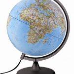 The Charleston Classic Globe
 South America Southern ITMB
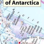 Antarctica Maps International Wall Map PAPER
 World: National Geographic Society Executive Style Political Wall Maps
 World NGS Classic Wall Map PAPER
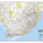 South Africa NGS Classic Wall Map PAPER
 World NGS Classic Wall Map LARGE PAPER