Disclosure : This site contains affiliate links to products. We may receive a commission for purchases made through these links.
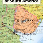
South America: Maps International Political Wall Maps

Brightly coloured political maps of South America at a scale of 1:7,000,000 with an inset of the Caribbean at 1:15,000,000.*Presentation:* on paper; encapsulated; with hanging strips.*Sizes:* 100x120cm – Encapsulated maps, and versions with hanging strips may be slightly larger than this though.Countries are shown in vivid colours against light blue oceans. Country names are in large, clearly legible print. English versions for capitals and most city names are used, with population information displayed on the legend; international and state boundaries are displayed. Major and minor railways are indicated where possible, with some major roads also shown.The maps have well designed relief shading to show mountainous areas enhancing the overall presentation, particularly on the large and extra large sizes. The colouring of the oceans shows different depths. Projection is Bipolar Oblique Conformal Conic.Each of the sizes contains a panel of country flags in the map corner.

Related Products:
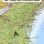 North America: Maps International Political Wall Maps
 Asia: Maps International Political Wall Maps
 Australasia: Maps International Political Wall Maps
 Africa: Maps International Political Wall Maps
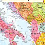 Europe: Maps International Political Wall Maps
 South America: Maps International Political Wall Map HANGING STRIPS
North America Maps International Political Wall Map HANGING STRIPS
South America: Maps International Political Wall Map HANGING STRIPS
North America Maps International Political Wall Map HANGING STRIPS
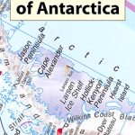 Antarctica: Maps International Wall Maps
South America Maps International Political Wall Map ENCAPSULATED
Antarctica: Maps International Wall Maps
South America Maps International Political Wall Map ENCAPSULATED
 South America Maps International Political Wall Map PAPER
Asia Maps International Political Wall Map HANGING STRIPS
Africa: Maps International Political Wall Map HANGING STRIPS
South America Maps International Political Wall Map PAPER
Asia Maps International Political Wall Map HANGING STRIPS
Africa: Maps International Political Wall Map HANGING STRIPS
 Europe: Maps International Political Wall Map LARGE, HANGING STRIPS
North America: Maps International Political Wall Map PAPER
Europe: Maps International Political Wall Map LARGE, HANGING STRIPS
North America: Maps International Political Wall Map PAPER
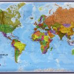
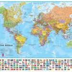
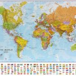
 World: Maps International Political Wall Maps
 World Maps International Political Wall Map SMALL HANGING-STRIPS (without flags)
 World Maps International Political Wall Map LARGE HANGING-STRIPS (without flags)
 World Maps International Political Wall Map MEDIUM HANGING-STRIPS (without flags)
Asia Maps International Political Wall Map PAPER
Africa Maps International Political Wall Map ENCAPSULATED
Asia Maps International Political Wall Map ENCAPSULATED
World Maps International Political Wall Map MEDIUM HANGING-STRIPS (without flags)
Asia Maps International Political Wall Map PAPER
Africa Maps International Political Wall Map ENCAPSULATED
Asia Maps International Political Wall Map ENCAPSULATED
 World Maps International Political Wall Map SMALL HANGING-STRIPS (with flags)
 Africa Maps International Political Wall Map PAPER
 World Maps International Political Wall Map LARGE HANGING-STRIPS (with flags)
 World Maps International Political Wall Map MEDIUM HANGING STRIPS (with flags)
 Europe Maps International Political Wall Map LARGE ENCAPSULATED
 Europe Maps International Political Wall Map X-LARGE ENCAPSULATED
Australasia Political Wall Map: HANGING STRIPS
Europe Maps International Political Wall Map X-LARGE ENCAPSULATED
Australasia Political Wall Map: HANGING STRIPS
 World Maps International Political Wall Map SMALL PIN-BOARD FRAMED without flags
Europe Maps International Political Wall Map X-LARGE PAPER
World Maps International Political Wall Map SMALL PIN-BOARD FRAMED without flags
Europe Maps International Political Wall Map X-LARGE PAPER
 World Maps International Political Wall Map SMALL PAPER
 World Maps International Political Wall Map SMALL ENCAPSULATED
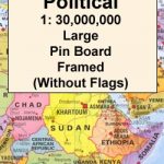 World Maps International Political Wall Map LARGE PIN-BOARD FRAMED without flags
 World Maps International Political Wall Map MEDIUM PIN-BOARD FRAMED without flags
 World Maps International Political Wall Map LARGE ENCAPSULATED
 Europe Maps International Political Wall Map PAPER LARGE
 World Maps International Political Wall Map MEDIUM PAPER
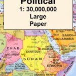 World Maps International Political Wall Map LARGE PAPER
 World Maps International Political Wall Map MEDIUM LAMINATED
 World Maps International Political Wall Map SMALL MAGNETIC-BOARD FRAMED without flags