Disclosure : This site contains affiliate links to products. We may receive a commission for purchases made through these links.
South Africa: Slingsby Maps Hiking Maps of the Cape Peninsula
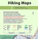
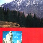
Cape Peninsula on high quality, detailed and GPS-compatible walking maps from Slingsby Maps, with excellent cartography, plenty of tourist information and printed on waterproof and tear-resistant synthetic paper. Contour lines are given at 10m or 20m intervals, and most maps show vegetation and terrain variations. Roads and footpaths are clearly drawn. Symbols indicate information for visitors to the area: car parks, view points, signposts, public toilets, picnic areas, places of interest, recreational and sport facilities, etc. Each map has a UTM grid. Additional notes provide background information, safety advice, emergency phone numbers, etc., and on some titles brief descriptions of hiking routes. All the maps were researched and drawn by Peter Slingsby – renowned environmental educator and cartographer.*For more information see descriptions of individual titles.

Related Products:
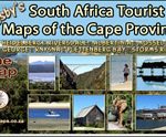 South Africa: Slingsby Maps Tourist Maps of the Cape Provinces
 Silvermine and Hout Bay
 Poland: Compass Hiking Maps
 Cape Point – Simon`s Town – Fish Hoek
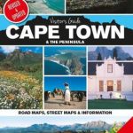 Cape Town & the Peninsula Map Studio Visitors Guide
 South Africa: 50K Hiking Maps of the Drakensberg Mountains
 South Africa: InfoMap Touring Maps
 South Africa: Map Studio Regional Tourist Maps
 Norway: Turkart 50K Topographic Hiking Maps
 Norway: Turkart 100K Topographic Hiking Maps
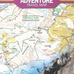 Cape Town & Peninsula NGS Adventure Map 3200
 Lyngen Peninsula South Nordeca 2781
 Hungary: Cartographia Hiking Maps
 Norway: Turkart 25K Topographic Hiking Maps
 Cederberg Mountains Hiking Set (2-map set)
 Cape Region – South Africa Reise Know-How
 New Zealand: NewTopo Hiking Maps
 Germany: Freytag & Berndt Hiking and Leisure Maps
 Greece: Terrain Editions Maps for Hiking and Recreational Pursuits
 Italy: Ed. Abies Recreational Maps of the Sardinian Coast
 Africa: ITMB Sectional Maps
 Cape Town & Peninsula Map Studio
 Cape York – Old Telegraph Track Hema
Slovenia: Alpine Club 50K and 25K Hiking Maps
Cape York – Old Telegraph Track Hema
Slovenia: Alpine Club 50K and 25K Hiking Maps
 Austria/Germany/Slovenia: Kompass Hiking Maps
 Cape Peninsula
 Iceland: Topographic Hiking and Tourist Maps
 Romania: Dimap Hiking Maps
 Golfing in the Cape Peninsula
 Poland: WZKart Hiking Maps
Italy: Tabacco 25K Maps of the Regional Parks in South Tyrol
Poland: WZKart Hiking Maps
Italy: Tabacco 25K Maps of the Regional Parks in South Tyrol
 Poland: ExpressMap Hiking Maps
 Romania: Bel Alpin Hiking Maps
 Germany: Kรผmmerly+Frey Hiking and Recreational Maps
 Cape Reinga Coastal Walkway
 Nepal: Nepa Trekking and Hiking Maps
 Czech Republic: Kompass 50K Hiking Maps
 Slovenia: Kartografija 75K Hiking Maps
 Cape Town – Cape Peninsula NP & Winelands