Disclosure : This site contains affiliate links to products. We may receive a commission for purchases made through these links.
Categories
-
Best Sellers
-

United Kingdom & Ireland Schofield & Sims Wall Map
The British Isles at 1:1,700,000 on a small, 53 x 77cm (1’9″ x 2’6″ approx), wall map from Schofield & Sims, with pleasant bright colours showing Read More » -
Moskenesoya & Flakstadoya – Lofoten
-

Castle Douglas 1894
Castle Douglas 1894 in a fascinating series of reproductions of old Ordnance Survey plans in the Alan Godfrey Editions, ideal for anyone interested in the history Read More » -
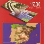
Purullena CNIG Topo 1010
Topographic coverage of mainland Spain at 1:50,000 in the MTN50 (Mapa Topogrรกfico Nacional) series from the Centro Nacional de Informaciรณn Geografica, the countryโ€s civilian survey organization. Read More » -

NGA Chart 51224 – Rade de Safi and Approaches
Produced by the US Government, National Geospatial-Intelligence Agency (NGA) charts provide information for the International Waters. They are printed on demand at our London shop and Read More » -

Notes from an Apocalypse: A Personal Journey to the End of the World and Back
From the prize-winning author of To Be a Machine – meet the men and women preparing for the end of the world In the remote mountains Read More » -

The Office of Gardens and Ponds
The village of Shimae is thrown into turmoil when master carp-catcher Katsuro suddenly drowns in the murky waters of the Kusagawa river. Who now will carry Read More » -

Pelayo CNIG Topographic Map 1078-III
Topographic coverage of mainland Spain at 1:25,000 published by the Centro Nacional de Informaciรณn Geograficรก, the country’s civilian survey organization. The maps have contours at 10m Read More » -

A Wild Life: A Visual Biography of Photographer Michael Nichols
-
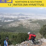
Northern & Southern Imitos / Mt Hymettus Anavasi 1.2
Two very detailed maps (printed on both sides) for Mt Imittos. The first (northern) covers the part of the mountain that extends between Agia Paraskevi and Read More »
-


