Disclosure : This site contains affiliate links to products. We may receive a commission for purchases made through these links.
Smolyan – Chepelare – Pamorovo and the Surrounding Area

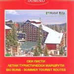
Street plans of Smolyan, Chepelare, each annotated with tourist facilities including a list of hotels, plus a contoured map of the surrounding region with hiking routes, and a panorama map of ski runs from the Snezhanka mountain.On one side is a street plan of Smolyan at 1:13,000 with an enlargement showing the town centre in greater detail. The plan shows bus routes with stops and line numbers, and is annotated with symbols highlighting locations of various facilities. Streets show selected house numbers for easier identification of addresses. Names of main streets are also given in Latin alphabet; street index is in Cyrillic alphabet only. Map legend includes English. The plan is accompanied by notes about the town and lists of various services and facilities in English, German and Bulgarian. Also provided is a separate list of hotels with contact details, etc..On the reverse are more maps and tourist information:* Street plan of Chepelare at 1:14,000, with street names in Cyrillic only, annotated with tourist accommodation and other services, and accompanied by a list of hotels.* A contoured map at 1:18,000 map of Pamporovo area including the Snezhanka Mountain, showing locations of hotels, car parks, ski or chair lifts, etc., plus a list of local hotels.* A contoured map at 1:85,000 of the surrounding mountains highlighting waymarked hiking paths, with tri-lingual descriptions of 12 routes.* A panorama map of ski runs from Snezhanka, graded according to the degree of difficulty.All map legends include English.

Related Products:
 Samokov – Borovets with the Rila Mountains
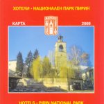 Bansko (with Pirin National Park)
 Bansko (with Ski Routes)
 Bulgaria (with Mountain Resorts)
 Stara Zagora
 Plovdiv
 Irkutsk
 Ruse
Ruse
 Lake Llanquihue and Surrounding Region
 Sofia Domino Street Plan
 Pokhara City – Lake Side Valley
 Novosibirsk
Odessa CYRILLIC
Novosibirsk
Odessa CYRILLIC
 Ahtopol – Sinemorets
 Pleven
 Arusha Town and Surrounding Area
 Tara National Park
 Pafos Pocket Street Plan
 Lviv ExpressMap Street Plan
 Larmaka Street Plan and District Road Map
 Shumen
 Omsk
Omsk
 Tbilisi and Environs Geoland Street Plan WATERPROOF
Tbilisi and Environs Geoland Street Plan
Tbilisi and Environs Geoland Street Plan WATERPROOF
Tbilisi and Environs Geoland Street Plan
 Varna
Varna
 Nicosia Pocket Street Plan
 Corfu Orama Editions 302
 Torres del Paine 50K/100K Trekkingchile Map
 Burgas and the Nearby Black Sea Resorts
 Rhodes Kompass 248
 Yalta Kartografija Street Plan
 Kos Geopsis 212
 Spetses Anavasi 10.30
 Spetses Terrain Editions 360
 Kaliningrad Street Plan
 Galicica National Park
 Dushanbe
 Constanta Cartographia Street Plan
 Skopelos Orama Editions 348