Disclosure : This site contains affiliate links to products. We may receive a commission for purchases made through these links.
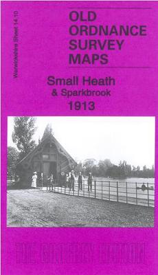
Small Heath & Sparkbrook 1913 – 14.10b

Related Products:
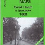 Small Heath & Sparkbrook 1888 – 14.10a Coloured Edition
 Wolverhampton (NE) & Heath Town 1913: Staffordshire Sheet 62.07c
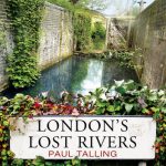
 The Heath: My Year on Hampstead Heath
 Enbury Heath
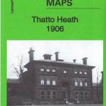 Thatto Heath 1906 – 107.08
 Newton Heath 1931 – 104.04c
 Stockport (Edgeley & Cheadle Heath) 1934 – 111.16c
 Kings Heath 1937: Warwickshire Sheet 19.01
 Luneburg Heath Marco Polo Leisure Map 11
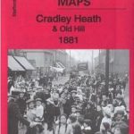 Cradley Heath & Old Hill 1881: Staffordshire Sheet 71.08a
Groote Peel – Strabrechtse Heath – Helenaveen ANWB Hiking Region Map
Cradley Heath & Old Hill 1881: Staffordshire Sheet 71.08a
Groote Peel – Strabrechtse Heath – Helenaveen ANWB Hiking Region Map
 Hampstead Heath
 On Hampstead Heath
 Bexley Heath 1862
 Newton Heath 1915
 Luneburg Heath Cycling Map
 Luneburg Heath Kompass 718
 Heath Robinson: On Travel
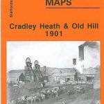 Cradley Heath and Old Hill 1901
Thornton Heath and Norbury 1894
Cradley Heath and Old Hill 1901
Thornton Heath and Norbury 1894
 Luneburg Heath – Hanover Cycling Map 7
 Frampton Cotterill & Coaplt Heath
Heath South – Gifhorn Cycling Map SUPERCEDED
Frampton Cotterill & Coaplt Heath
Heath South – Gifhorn Cycling Map SUPERCEDED
 Rivers of the Luneburg Heath Cycle Routes
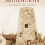
 Frampton Cotterell & Coalpit Heath Revisited
Heanor 1913 – 45.04
Frampton Cotterell & Coalpit Heath Revisited
Heanor 1913 – 45.04
 Uxbridge 1913 – 14.03b
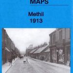 Methil 1913 – 28.08a
 Longbenton 1913 – 31
 Old Thornaby 1913 – 56.04
 Morriston 1913 – 15.09
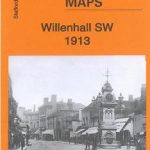 Willenhall SW 1913 – 62.12b
 Walsall (SW) 1913 – 63.10b
 Walsall (SE) 1913 – 63.11b
 Walsall (NW) 1913 – 63.06b
 Bilston 1913 – 62.16c
 Smethwick 1913 – 72.03b
 Luneburg Heath Cycle Tour Bikeline Map-Guide
 Lofthousegate & Outwood 1913 – 233.11
 Nottingham (South) 1913 – 42.06c