Disclosure : This site contains affiliate links to products. We may receive a commission for purchases made through these links.
Slovenia Kartografija Road Atlas

Slovenia at 1:75,000 presented in an A4, paperback road atlas from the Ljubljana-based Kartografija with very detailed GPS-compatible mapping at 1:75,000, including vivid presentation of the topography, extensive tourist overprint, plus 11 indexed street plans, a distance table, etc. Coverage includes the border areas of Italy around Trieste and Gorizia. The atlas shows names of numerous villages not marked on road maps of the whole country at less detailed scales.Landscape is very effectively presented by relief shading with plenty of spot heights and names of topographic features such as mountain ranges, valleys, peaks, etc, plus boundaries of national parks. Road network is graded into 10 types, from motorways to forest roads, indicating unsurfaced roads, services and petrol stations, restrictions for caravans, and driving distances on main and secondary routes. A range of symbols indicate various facilities and places of interest including campsites, motels, tourist farms and other types of accommodation, inns and wine cellars or shops, spas, etc. The maps have latitude and longitude lines at 5’ intervals. Map legend includes English. The atlas also includes indexed one or two-page street plans of Ljubljana, Celje, Koper, Kranj, Maribor, Murska Sobota, Nova Gorica, Novo Mesto, Ptuj, Slovenj Gradec and Velenje. Symbols show car parks and petrol stations, hotels, shopping centres, tourist information offices and other facilities.

Related Products:
 Ukraine Kartografija Road Atlas 500K HARDBACK
 Croatia – Slovenia F&B Road Atlas
 Belarus Road Atlas
 Finland Road Atlas GLOVEBOX, SPIRAL-BOUND
 Latvia Jana Seta Road Atlas
 Crimea Road Atlas
 Lithuania Jana Seta Road Atlas HARDBACK
Ukraine Road Atlas (500K, Spiral-bound)
Lithuania Jana Seta Road Atlas HARDBACK
Ukraine Road Atlas (500K, Spiral-bound)
 Latvia Jana Seta Compact Road Atlas
Iceland Road Atlas 500K
Latvia Jana Seta Compact Road Atlas
Iceland Road Atlas 500K
 Thailand Handy Road Atlas
 Lithuania Jana Seta Compact Road Atlas
 Czech Republic 100K Tourist Road Atlas
 Poland ExpressMap Professional Users Road Atlas 2020/2021
Poland ExpressMap Road Atlas 2020/2021
Poland ExpressMap Professional Users Road Atlas 2020/2021
Poland ExpressMap Road Atlas 2020/2021
 India Road Atlas
Italy F&B Great Road Atlas SPIRAL-BOUND
India Road Atlas
Italy F&B Great Road Atlas SPIRAL-BOUND
 Alberta MapArt Back Road Atlas
Iceland Mal og menning Road Atlas 2021-2023
Alberta MapArt Back Road Atlas
Iceland Mal og menning Road Atlas 2021-2023
 Lithuania Road Atlas
 Namibia Map Studio Road Atlas
 Sweden F&B Road Atlas
Poland: Carta Blanca/Kompas Road Atlas 2015 GLOVEBOX, SPIRAL-BOUND
Sweden F&B Road Atlas
Poland: Carta Blanca/Kompas Road Atlas 2015 GLOVEBOX, SPIRAL-BOUND
 Italy Road Atlas A4 PAPERBACK
 Estonia Jana Seta Road Atlas
 Finland Karttakeskus Motorbikers Road Atlas A5 SPIRAL-BOUND
 Norway Cappelens Road Atlas A4 SPIRAL-BOUND
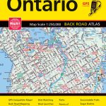 Ontario MapArt Back Road Atlas
 Netherlands Falk Maxi Road Atlas A4 SPIRALBOUND
Netherlands Falkplan Routiq Road Atlas
Netherlands Falk Maxi Road Atlas A4 SPIRALBOUND
Netherlands Falkplan Routiq Road Atlas
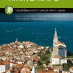 Slovenia: Kartografija 75K Hiking Maps
New Zealand Kiwimaps Travellers Road Atlas
Slovenia: Kartografija 75K Hiking Maps
New Zealand Kiwimaps Travellers Road Atlas
 USA – Southern Canada Marco Polo Road Atlas A4 SPIRAL-BOUND
 Barcelona: Greater Barcenona Telstar Street Atlas
 Manitoba & Saskatchewan MapArt Road Atlas
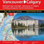 Vancouver to Calgary MapArt Back Road Atlas
 Slovakia Road Atlas
 Lake Balaton Cycling Atlas
 Hungary Pocket Road Atlas SPIRAL-BOUND
 Croatia – Slovenia – Bosnia-Hercegovina Marco Polo Road Atlas