Disclosure : This site contains affiliate links to products. We may receive a commission for purchases made through these links.
Skopje Street Atlas
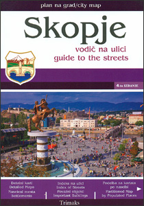
Skopje with its outer suburbs in a street atlas at 1:22,222 approx. from the locally based Trimaks, highlighting locations of various facilities and places of interest, , including hotels, banks, shopping malls, embassies, etc. Streets are shown with their names plus numbers and/or just numbers, and in some districts on housing estates individual buildings have numbers. In the outlaying suburbs only main streets are named. The plan indicates main traffic arteries and shows one way streets, car parks and locations of petrol stations. A wide range of symbols indicate various facilities and places of interest. All place names are in the Latin alphabet. Each page has its individual index, and there is a combined double index at the back of the atlas: alphabetically (but according to the Cyrillic alphabet, a, b, v, g, etc) and by street number. Also provided are lists of useful addresses and/or phone numbers, including selected embassies, hotels, banks, etc., plus a road map of Macedonia for route planning. Map legend includes English.

Related Products:
 Delhi Street Atlas
 Sofia Street Atlas with Vitosha Massif
 Zurich Pocket Street Atlas
 Mumbai (Bombay) Street Atlas
 Chennai / Madras Street Atlas
 Doha Street Plan
 Skopje
 Prague Street Atlas
 Zurich Street Atlas
 Oslo Cappelen Street Atlas
 Cape Town – Western Cape Towns Map Studio Street Atlas
 Riga and Vicinity Jana Seta Street Atlas
 Australia: UBD Gregory`s Street Maps and Directories
 Sofia Domino Street Plan
 Lille and Surroundings Blay-Foldex Street Atlas
Nantes and Surroundings Blay-Foldex Street Atlas
Marseille and Surroundings Blay-Foldex Street Atlas
Lille and Surroundings Blay-Foldex Street Atlas
Nantes and Surroundings Blay-Foldex Street Atlas
Marseille and Surroundings Blay-Foldex Street Atlas
 Bordeaux and Surroundings Blay-Foldex Street Atlas
 Budapest Street Atlas
 Skopje Panoramic Street Plan
 Bangkok Handy Atlas
 Brisbane UBD Gregory`s City Pocket 460
 Tokyo City Atlas – a Bilingual Guide
 Limassol Pocket Street Plan
 Chalkidiki / Halkidiki – Thessaloniki Street Plan Terrain Editions 412
 Toronto & Area MapArt Street Atlas
 Moscow Jana Seta Street Plan
 Kolkata / Calcutta Street Atlas
 Norwich A-Z Street Atlas
 Navi Mumbai Street Atlas
 Pune City Street Atlas
 Manhattan Block-by-Block Street Atlas
 St. Petersburg Jana Seta Street Plan
 Valencia Pocket Street Atlas
 Poznan ExpressMap Street Plan
 Bucharest Street Atlas
 Vitosha – Verila
 Barcelona: Greater Barcenona Telstar Street Atlas
 Taunton A-Z Street Atlas
 Amsterdam Falkplan Street Plan