Disclosure : This site contains affiliate links to products. We may receive a commission for purchases made through these links.
Simental – Saanenland K+F Hiking Map 17
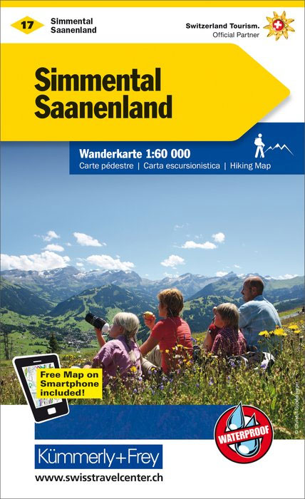
Simental – Saanenland area, including Gstaad, Saanen, Lenk, Adelboden, Kandersteg, Frutigen, Zweisimmen, Thun and the peak of Wildstrubel, at 1:60,000 in Kรผmmerly + Frey’s hiking series of Switzerland, with most titles now printed on light, waterproof and tear-resistant plastic paper. The series offers a popular alternative to Swiss survey maps and cartography which many walkers find easier to follow.Coverage of the whole country is designed so that each title presents a popular hiking area. The maps have contours at 50 or 25-metre intervals according to the terrain, enhanced by graphic relief and shading. An overprint distinguishes between sign-posted hiking paths, mountain path where proper walking shoes are necessary, and alpine paths requiring special equipment. Most titles now also indicate national and regional long-distance hiking routes, each annotated with its official number.Mountain huts are marked, plus various types of accommodation: campsites, youth hostels, ‘Friends of Nature” houses, and secluded hotels and restaurants. Road network indicates local bus routes with stops. Railways, narrow gauge mountain railways, cable car lines, and chair lifts are shown, with various symbols highlighting places of interest, viewpoints, picnic sites, swimming pools, etc.Each title covers an area of approximately 60 x 42 km (37 x 26 miles). The maps have a 1km Swiss national grid, plus latitude and longitude margin ticks at 5’ intervals. *Map legend includes English.* On the reverse, an index of towns and villages includes names of geographical features such as mountains, alpine passes, glaciers, lakes, rivers, as well as places of interest. Also provided is an overview road map of surrounding region.

Related Products:
 Zurich K+F Hiking Map 6
 Fribourg K+F Hiking Map 31
 Bern K+F Hiking Map 9
 Geneva Region K+F Hiking Map 21
 Schaffhausen – Winterthur K+F Hiking 1
 Aletsch – Goms K+F Hiking Map 25
 Sarganserland – Liechtenstein K+F Hiking Map 30
 Basel – Olten – Solothurn 60K K+F Hiking Map No.4
 Lake Constance K+F Hiking Map 2
 Emmental – Napf – Entlebuch K+F Hiking 10
 Neuchรขtel – Val-de-Travers – Val-de-Ruz K+F Hiking Map 8
 Aargau – Fricktal – Hallwilersee K+F Hiking Map 5
 Glarnerland – Walensee – Muotatal – Klausenpass 60K K+F Hiking Map No. 12
 Gotthard – Grimsel – Susten – Oberalp K+F Hiking Map 19
 Surselva – Disentis – Valsertal – Flims K+F Hiking Map 20
St. Gallen – Appenzellerland – Toggenburg – Sรคntis K+F Hiking Map 7
Surselva – Disentis – Valsertal – Flims K+F Hiking Map 20
St. Gallen – Appenzellerland – Toggenburg – Sรคntis K+F Hiking Map 7
 Splรผgen – San Bernardino – Hinterrheintรคler – Misox K+F Hiking Map 27
 Jura – Franches-Montagnes – Ajoie K+F Hiking 3
 Lausanne – Vallรฉe de Joux – La Cรดte ‘“ St-Cergue K+F Hiking Map 15
 Ticino North – Valle Maggia – Leventina K+F Hiking Map 26
Davos – Arosa – Lenzerheide – Prรคttigau K+F Hiking Map 13
Ticino North – Valle Maggia – Leventina K+F Hiking Map 26
Davos – Arosa – Lenzerheide – Prรคttigau K+F Hiking Map 13
 Unterengadin / Lower Engadine – Nationalpark – Val Mustair K+F Hiking 14
 Gruyรจre – Molรฉson – La Broye – Pays d`Enhaut – Leysin K+F Hiking Map 16
 Lake Lucerne – Engelberg – Lucerne – Schwyz K+F Hiking Map 11
 Val d`Anniviers – Val d`Hรจrens K+F Hiking Map 23
 Grand-St-Bernard – Dents du Midi – Verbier – Ovronnaz K+F Hiking Map 22
 Zermatt – Saas Fee – Grachen – Visp – Simplon K+F Hiking Map 24
 Heidiland – UNESCO Tectonic Arena Sardona 50K K+F Hiking Map No. 33
 Ticino South – Lugano – Lake Maggiore K+F Hiking Map 29
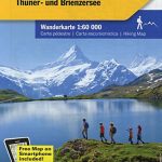 Jungfrau Region – Lakes Thun and Brienz K+F Hiking Map 18
 Oberengadin / Upper Engadine – Bergell – Puschlav K+F Hiking Map 28
 Crans-Montana K+F Hiking Map 32
Switzerland: Kรผmmerly + Frey 60K Walking Maps
Crans-Montana K+F Hiking Map 32
Switzerland: Kรผmmerly + Frey 60K Walking Maps
 Hauenstein – Belchenflue Swisstopo Hiking 3325T
 Schaffhausen – Klettgau – Randen – Stein am Rhein Swisstopo Hiking 3329T
Lugano – Mendrisiotto Swisstopo Hiking 3328T
Schaffhausen – Klettgau – Randen – Stein am Rhein Swisstopo Hiking 3329T
Lugano – Mendrisiotto Swisstopo Hiking 3328T
 Lotschental – Aletschgebiet 33K Swisstopo Hiking 3324T
 Arosa – Davos Swisstopo Hiking 3309T
 Chasseral
Prรคttigau Swisstopo Hiking 248T
Chasseral
Prรคttigau Swisstopo Hiking 248T