Disclosure : This site contains affiliate links to products. We may receive a commission for purchases made through these links.
Sierras de Tejeda, Almijara y Alhama 2-Map Set
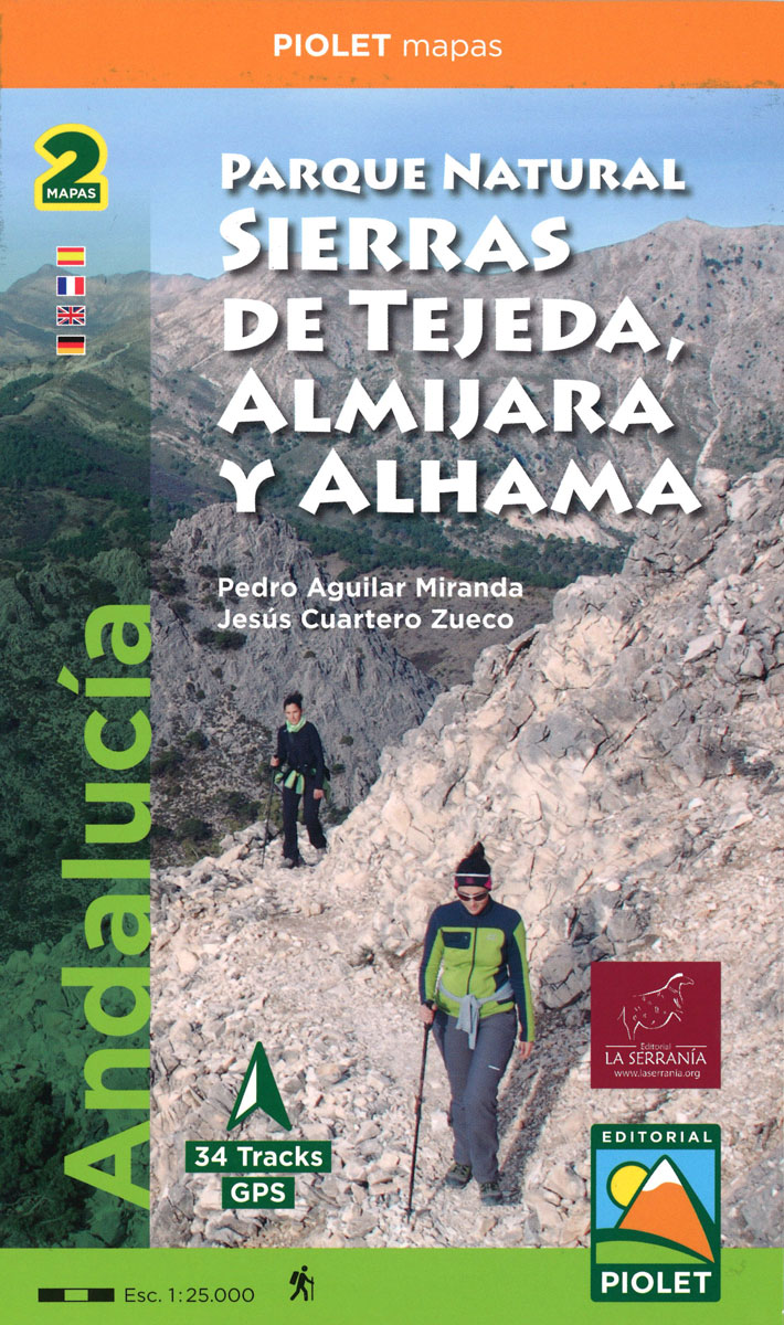
Sierras de Tejeda, Almijara y Alhama, popular hiking area east of Vรฉlez-Mรกlaga, at 1:40,000 on a detailed, GPS compatible topographic map from the Instituto de Cartografia de Andalucรญa, the region’s official survey organization, printed on light, waterproof and tear-resistant synthetic paper. Coverage along the coast extends from Velez-Malaga and Torre del Mar eastwards past Torrox Costa and Nerja to La Herrandura, and inland to the southern tip of the Bermejales Reservoir.The map has contours at 20m intervals plus relief shading, with colours and symbols providing large amount of information on different types of local vegetation, and shows waymarked hiking trails and other local footpaths. Symbols indicate information centres, campsites, mountain refuges, accessible caves, etc. Latitude/longitude and UTM values are shown by margin ticks. Map legend is in Spanish only.PLEASE NOTE: deliveries of all publications by the Instituto de Cartografia de Andalucia are very irregular and we cannot, unfortunately, stipulate any firm delivery time for maps currently out of stock. It is advisable in such cases to choose titles from other publishers.

Related Products:
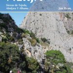 The Mountains of Nerja: Sierras de Tejeda, Almijara Y Alhama
 Sierras de Urbiรณn, Neila y Cebollera
Sierras de Ayllรณn and Ocejรณn
Sierras de Urbiรณn, Neila y Cebollera
Sierras de Ayllรณn and Ocejรณn
 Sierra de Marรญa-Los Vรฉlez Natural Park Editorial Piolet
 Geoparque de las Sierras Subbeticas Editorial Piolet
 Spanish Trails – A guide to walking the Spanish mountains: Book Two: The Sierra Almijara and Tejeda
 Vall de Barravรฉs – Ribagorรงa Editorial Alpina
 Rasos de Peguera – Serra d`Ensija Editorial Alpina
 Muntanya d’Alinyร Editorial Alpina
 Val d`Aran – Mauberme – Montardo – Molieres Editorial Alpina
Garraf – la Morella – Eramprunya Editorial Alpina
Val d`Aran – Mauberme – Montardo – Molieres Editorial Alpina
Garraf – la Morella – Eramprunya Editorial Alpina
 Posets-Maladeta Natural Park 2-Map Set Editorial Alpina
 Congost de Mont-rebei Editorial Alpina
 Valles de Irati y Aezkoa Editorial Alpina
Val d`Aran by UTMB Editorial Alpina Trail running race Map
Valles de Irati y Aezkoa Editorial Alpina
Val d`Aran by UTMB Editorial Alpina Trail running race Map
 Montseny NP – Turo de l`Home – Les Agudas – Matagalls – la Calma Editorial Alpina 2-Map Set
Sant Llorenc del Munt i l`Obac Editorial Alpina
Montseny NP – Turo de l`Home – Les Agudas – Matagalls – la Calma Editorial Alpina 2-Map Set
Sant Llorenc del Munt i l`Obac Editorial Alpina
 Montseny Editorial Alpina
Puigsacalm – Bellmunt Editorial Alpina
Montseny Editorial Alpina
Puigsacalm – Bellmunt Editorial Alpina
 El Turbรณn ‘“ Alto Valle de Isรกbena Editorial Alpina
 Sierra de Gredos: Valles del Alberche y del Tiรฉtar
Cingles de Berti – Sant Miquel des Fai Editorial Alpina
Sierra de Gredos: Valles del Alberche y del Tiรฉtar
Cingles de Berti – Sant Miquel des Fai Editorial Alpina
 Fagaras Mountains Dimap Hiking Map
 Valles de Belagua y Roncal Editorial Alpina
 Delta of the Ebro ‘“ Serra de Montsiร Editorial Alpina
Valles de Ansรณ & Echo Editorial Alpina
Delta of the Ebro ‘“ Serra de Montsiร Editorial Alpina
Valles de Ansรณ & Echo Editorial Alpina
 Catllarร s – Picancel Editorial Alpina
 Valle de Canfranc – Valle de Aisa – Candanchu – Astun Editorial Alpina
 Sierras Peladas CNIG Topo 687-1
 Ripollรจs Editorial Alpina
Cerdanya – Alta Cerdanya – Capcir – Andorra Editorial Alpina
Ripollรจs Editorial Alpina
Cerdanya – Alta Cerdanya – Capcir – Andorra Editorial Alpina
 Andalucia, Costa del Sol and Sierras Sunflower Landscape Guide
 Padis Dimap Hiking Map
 Montgrony – Fonts del Llogregat – Parc Natural del Cadรญ-Moixerรฒ Editorial Alpina
 Mt Paggaio
 Alhama de Almeria CNIG Topo 1044
 Corsica North Didier Richard 08
 The Sierras of Extremadura: 32 half and full day walks in western Spain`s hills
 Landscapes along the River Ter Ed. Alpina 40K Map
 Corsica South Didier Richard 09