Disclosure : This site contains affiliate links to products. We may receive a commission for purchases made through these links.
Sierra Nevada – Las Alpujarras CNIG Map
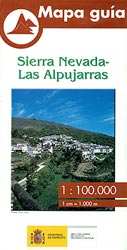
Sierra Nevada Mountain, southern Spain’s most popular national park, on GPS compatible map at 1:100,000 from IGN/CNIG with cartography based on their civilian topographic survey of Spain, plus a panorama drawing of the mountains as seen from the coast. The map covers a large area, extending from Granada in the west to beyond Gรฉrgal in the east, with Almerรญa in the south-eastern corner, and from Berja.in the south northwards to Guadix.Contour lines are at 100m intervals but still provides a vivid representation of the topography through very effective relief shading and altitude colouring based on satellite imagery and has plenty of names of topographic features. PR and GR hiking trails are highlighted and small symbols indicate various landmarks. The map has a 5km UTM grid and margin ticks showing latitude and longitude at 5` intervals. Map legend is in Spanish only. Below the map is a panoramic view of the mountains and the adjacent coast on which numerous peaks are identified.To see other titles in this series please click on the series link.

Related Products:
 Sierra Nevada – the Traverse at 3000m Editorial Piolet
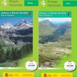
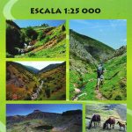
 Sierra Nevada – La Alpujarra Editorial Alpina
 Sierra Nevada – the Alpujarra – Marquesado del Zenete Editorial Penibetica Map and Guide
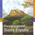 Sierra de Espuรฑa Natural Park CNIG Map
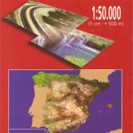
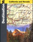 Sierra Nevada Destination Map
 Sierra de Ancares Natural Park CNIG Map
Sierra de Bรฉjar
Sierra de Ancares Natural Park CNIG Map
Sierra de Bรฉjar
 Sierra Nevada Mountain Guidebook
 Sierra Nevada
 Granada & Sierra Nevada
 Sierra Crestellina – Sierra de la Utrera Birding Map
 Valle de Ricote – Sierra de Ricote – Sierra del Oro
 Sierra de Guadarrama National Park 4-Map and Guide Set CNIG
 Sierra de Gredos: Valles del Alberche y del Tiรฉtar
 Sierra Norte Natural Park CNIG Map
 50 Hikes in the Sierra Nevada
 Urbion – Viniegras and Sierra de Castejon
Quintanar de la Sierra CNIG Topo 316
Sierra de la Pila Regional Park
Urbion – Viniegras and Sierra de Castejon
Quintanar de la Sierra CNIG Topo 316
Sierra de la Pila Regional Park
 Guejar Sierra CNIG Topo 1027-1
 Salamanca – Sierra de Gredos – Madrid 500K CNIG Regional Map No. 5
 Sierra de Guadarrama
Villalba de la Sierra CNIG Topo 587
Sierra de Guadarrama
Villalba de la Sierra CNIG Topo 587
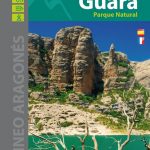
 Sierra de Guara – PN Sierra y Canones de Guara Rando Editions 14
 Sierra de Castril
 Gรผejar Sierra CNIG Topo 1027
 GR 240: Tour of the Sierra Nevada (Sendero Sulayr)
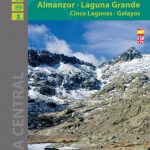 Sierra de Gredos – Almanzor – Laguna Grande Editorial Alpina
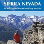 Walking and Trekking in the Sierra Nevada: 38 walks, scrambles and multi-day traverses
 John Muir Trail – Through the Californian Sierra Nevada
 Sierra de las Nieves Map/Guide (Spanish ed.)
 Sierra de Grazalema Editorial Penibetica
 Sierra de Segura Editorial Penibetica
 Sierra de Huetor Natural Park Editorial Penibetica SPANISH
 Sierra de Leire Map/Guide
 Sierra y Canones de Guara Editorial Alpina
 Sierra de Urbasa Map/Guide
 Sierra de Marรญa-Los Vรฉlez Natural Park Editorial Piolet
 Macizo Central de Gredos CNIG
 Spanish Trails – A guide to walking the Spanish mountains: Book Two: The Sierra Almijara and Tejeda