Disclosure : This site contains affiliate links to products. We may receive a commission for purchases made through these links.
Sierra Espuรฑa – Barrancos de Gebas – La Muela Editorial Piolet
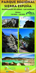
Sierra Espuรฑa – Barrancos de Gebas – La Muela area west of Murcia on a contoured and GPS compatible map from Editorial Piolet. On one side is a wider area presented at 1:35,000 ‘“ coverage extends west from Alhama de Murcia across Sierra Espuรฑa and north to Mula, with a separate panel at 1:25,000 extending the main map directly north of Alhama de Murcia to cover Sierra de la Muela and Barrancos de Gebas. On the reverse Sierra Espuรฑa is also covered at 1:25,000, with its central area shown in greater detail at 1:15,000.Topography is presented by contours at 10m intervals with plenty of additional spot heights. An overprint shows waymarked local and long-distance hiking routes. Symbols indicate various facilities and places of interest including different types of accommodation (hotels, campsites, gรฎtes, etc), tourist information offices, petrol stations and car parks, interesting natural sites, etc. The map has a 1-km UTM grid; map legend includes English. To see the list of titles in this series please click on the series link.

Related Products:
 Sierra de Espuรฑa Natural Park CNIG Map
 Valle de Ricote – Sierra de Ricote – Sierra del Oro
 Sierra Nevada – the Traverse at 3000m Editorial Piolet
 Sierra de Marรญa-Los Vรฉlez Natural Park Editorial Piolet
 Sierra de Cazorla – Sierra de Castril Editorial Penibetica
 Sierra Nevada – La Alpujarra Editorial Alpina
 Sierra de Gredos – Almanzor – Laguna Grande Editorial Alpina
 Sierra de Grazalema Editorial Penibetica
 Sierra de Castril
 Sierra Crestellina – Sierra de la Utrera Birding Map
 Hiking Alt Camp Editorial Piolet
 Sierra de Huetor Natural Park Editorial Penibetica SPANISH
 Sierra y Canones de Guara Editorial Alpina
 La Ruta del Caracremada Editorial Piolet
 Sierra de las Nieves Natural Park Editorial Penibetica Maps and Guide
 Sierra de Cazorla Editorial Penibetica
 Sierra de Segura Editorial Penibetica
 Sierra Nevada – the Alpujarra – Marquesado del Zenete Editorial Penibetica Map and Guide
 El Montgo Editorial Piolet
Marina Baixa – Serra d`Aitana Editorial Piolet
El Montgo Editorial Piolet
Marina Baixa – Serra d`Aitana Editorial Piolet
 Serra de Bernia – Marina Alta Editorial Piolet
 Sierra de Guara – PN Sierra y Canones de Guara Rando Editions 14
 Ighil Mgoun Editorial Piolet
El Moncayo Editorial Piolet
Ighil Mgoun Editorial Piolet
El Moncayo Editorial Piolet
 Serra de Llaberia Editorial Piolet
 Sierra Norte Natural Park CNIG Map
 Barrancos
 Geoparque de las Sierras Subbeticas Editorial Piolet
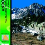 Cami de l`Ossa – Andorra Editorial Piolet
 Sierra Norte de Madrid
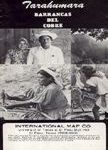 Sierra Tarahumara
 Sierra de Gredos Adrados Map
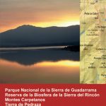
 Sierra de Guadarrama
 Macizo de Revolcadores
 Sierra de Guadarrama National Park 4-Map and Guide Set CNIG
 Sierra de Urbasa Map/Guide
 Granada & Sierra Nevada
 Sierra Nevada – Las Alpujarras CNIG Map
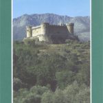 Sierra de Gredos: Valles del Alberche y del Tiรฉtar
 Urbion – Viniegras and Sierra de Castejon