Disclosure : This site contains affiliate links to products. We may receive a commission for purchases made through these links.
Sierra de Grazalema Editorial Penibetica
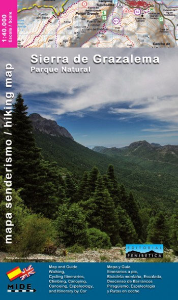
Sierra de Grazalema on a double-sided, contoured and GPS compatible map at 1:40,000 from Editorial Penibetica, highlighting local hiking trails and cycling routes.Contours are at 20m intervals enhanced by relief shading. The overprint highlights hiking trails and cycling routes, with numbers cross-referencing them to descriptions in the guide. Also marked are various places of interest and facilities including information centres, campsites, petrol stations, etc. The map has a 1-km UTM grid, plus latitude and longitude margin ticks at 2’ intervals. Map legend includes English. The map comes with a 60-page booklet in English providing descriptions of several recommended walks and mountain bike routes, details of local accommodation and general information about the area. To see other titles in this series please click on the series link.

Related Products:
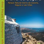
 Sierra de Cazorla Editorial Penibetica
 Sierra de Huetor Natural Park Editorial Penibetica SPANISH
 Sierra Nevada – the Alpujarra – Marquesado del Zenete Editorial Penibetica Map and Guide
 Sierra de Segura Editorial Penibetica
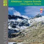 Sierra de Gredos – Almanzor – Laguna Grande Editorial Alpina
 Sierra Nevada – La Alpujarra Editorial Alpina
 Torcal de Antequera – Lagoons Fuente de Piedra, Campillos, Ratosa & Archidona Editorial Penibetica ENGLISH
Torcal de Antequera – Lagoons Fuente de Piedra, Campillos, Ratosa & Archidona Editorial Penibetica SPANISH
Sierra de las Nieves Map/Guide (Spanish ed.)
Torcal de Antequera – Lagoons Fuente de Piedra, Campillos, Ratosa & Archidona Editorial Penibetica ENGLISH
Torcal de Antequera – Lagoons Fuente de Piedra, Campillos, Ratosa & Archidona Editorial Penibetica SPANISH
Sierra de las Nieves Map/Guide (Spanish ed.)
 Sierra Crestellina – Sierra de la Utrera Birding Map
 Sierra de Cazorla – Sierra de Castril Editorial Penibetica
 Sierra Nevada – the Traverse at 3000m Editorial Piolet
 Sierra de Marรญa-Los Vรฉlez Natural Park Editorial Piolet
Puigsacalm – Bellmunt Editorial Alpina
Sant Llorenc del Munt i l`Obac Editorial Alpina
Sierra de Marรญa-Los Vรฉlez Natural Park Editorial Piolet
Puigsacalm – Bellmunt Editorial Alpina
Sant Llorenc del Munt i l`Obac Editorial Alpina
 Congost de Mont-rebei Editorial Alpina
Cingles de Berti – Sant Miquel des Fai Editorial Alpina
Congost de Mont-rebei Editorial Alpina
Cingles de Berti – Sant Miquel des Fai Editorial Alpina
 Valles de Ansรณ & Echo Editorial Alpina
Val d`Aran – Mauberme – Montardo – Molieres Editorial Alpina
Valles de Ansรณ & Echo Editorial Alpina
Val d`Aran – Mauberme – Montardo – Molieres Editorial Alpina
 El Turbรณn ‘“ Alto Valle de Isรกbena Editorial Alpina
 Catllarร s – Picancel Editorial Alpina
Garraf – la Morella – Eramprunya Editorial Alpina
Catllarร s – Picancel Editorial Alpina
Garraf – la Morella – Eramprunya Editorial Alpina
 Valles de Irati y Aezkoa Editorial Alpina
 Montes de Malaga Map-Guide ENGLISH
 Sierra de Guadarrama National Park 4-Map and Guide Set CNIG
 Montseny Editorial Alpina
 Montgrony – Fonts del Llogregat – Parc Natural del Cadรญ-Moixerรฒ Editorial Alpina
 Delta of the Ebro ‘“ Serra de Montsiร Editorial Alpina
 Ripollรจs Editorial Alpina
Val d`Aran by UTMB Editorial Alpina Trail running race Map
Ripollรจs Editorial Alpina
Val d`Aran by UTMB Editorial Alpina Trail running race Map
 Valle de Canfranc – Valle de Aisa – Candanchu – Astun Editorial Alpina
 Rasos de Peguera – Serra d`Ensija Editorial Alpina
 Sierra Espuรฑa – Barrancos de Gebas – La Muela Editorial Piolet
 Montseny NP – Turo de l`Home – Les Agudas – Matagalls – la Calma Editorial Alpina 2-Map Set
 Muntanya d’Alinyร Editorial Alpina
Spain: Editorial Alpina Walking Maps
Collserola Parc Natural Editorial Alpina
Muntanya d’Alinyร Editorial Alpina
Spain: Editorial Alpina Walking Maps
Collserola Parc Natural Editorial Alpina
 Sierra de las Nieves Natural Park Editorial Penibetica Maps and Guide
 Sierra de Gredos: Valles del Alberche y del Tiรฉtar
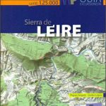 Sierra de Leire Map/Guide