Disclosure : This site contains affiliate links to products. We may receive a commission for purchases made through these links.
Sierra de Grazalema Complete Guidebook
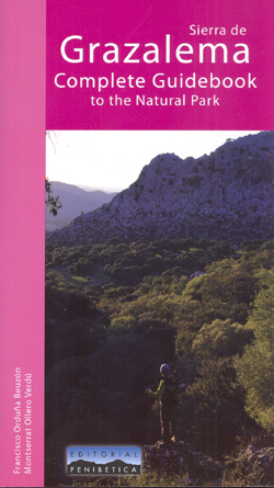
Sierra de Grazalema Complete Guidebook to the Natural Park, in English from Editorial Penibetica, publishers specializing in detailed, contoured walking maps of Andalucรญa. The guide features trail routes (reserve area and free access, as well as peni-urban trails) and long distance trails in the area, as well as mountain bike routes, canoe routes, paragliding and hang gliding areas, rock climbing areas and car touring routes. Canyons and caves in the park are detailed. Colour extracts from the publishers’ maps, with relevant routes overprinted, accompany the text.The guidebook is colour coded by trail/route type, with details given including duration, difficulty, length, and altitude/height loss. Symbols relating to routes use the common MIDE (Method of Tour Information) system ‘“ using a 1-5 evaluation scale of environment, itinerary, movement and effort. Route descriptions contain details of interesting topographic features, flora and fauna and trail routes are presented with altitude/distance cross section graphs. A listing of lodgings is given with website addresses and telephone contacts for tourist centres etc in the area.

Related Products:
 Sierra Nevada Mountain Guidebook
 Trekking the Hadrian`s Wall Path (National Trail Guidebook with OS 1:25k maps): Two-way guidebook: described east-west and west-east
 The Mountains of Ronda and Grazalema: Grazalema and La Sierra de las Nieves Natural Parks, Genal and Guadiaro valleys
 Trekking the Tour of Mont Blanc: Complete two-way hiking guidebook and map booklet
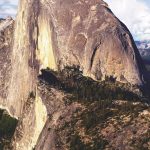 The Complete Guidebook to Yosemite National Park
 Kalymnos Rock Climbing Guidebook
 Sierra de Grazalema Editorial Penibetica
 Sierra de Cazorla – Sierra de Castril Editorial Penibetica
 The Canadian Rockies Trail Guide
 Sierra Nevada – the Traverse at 3000m Editorial Piolet
 GR 240: Tour of the Sierra Nevada (Sendero Sulayr)
 Walk! Sierra de Aracena
Sierra de la Pila Regional Park
Sierra Crestellina – Sierra de la Utrera Birding Map
Walk! Sierra de Aracena
Sierra de la Pila Regional Park
Sierra Crestellina – Sierra de la Utrera Birding Map
 National Trails of England, Scotland & Wales – 2nd ed.
 Trail and Fell Running in the Lake District: 40 Routes in the National Park Including Classic Routes
 Urbion – Viniegras and Sierra de Castejon
 Sierra de Segura Editorial Penibetica
 Jewish London, 3rd Edition: A Comprehensive Guidebook for Visitors and Londoners
 Sierra de Guadarrama National Park 4-Map and Guide Set CNIG
 Great Britain & Ireland: Rucksack Readers` Guides to Long-distance Footpaths
 Hungarian National Long-distance Blue Trail (E7): Irott-ko to Szekszard
Sierra de Bรฉjar
Hungarian National Long-distance Blue Trail (E7): Irott-ko to Szekszard
Sierra de Bรฉjar
 Black Forest Complete 4-Map Set Kompass 888
 Sierra de Leire Map/Guide
 Pembrokeshire Coastal Path
 White Peak Mountain Biking: The Pure Trails
 Sierra de Urbasa Map/Guide
 Isle of Skye – Graded walks and Scrambles throughout the Island
 The Grahams & the Donalds: Scottish Mountaineering Club Hillwalkers` Guide
 The GR5 Trail – Lake Geneva to Nice
 Photographing The Snowdonia Mountains: A photo-location and hill walking guidebook
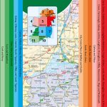
 Britain and Northern Ireland Collins Essential Road Atlas 2021
 Ireland Collins Handy Map
 Aspen CO Local Trails NGS Map-Guide
 Cleveland Way
 Sierra de Marรญa-Los Vรฉlez Natural Park Editorial Piolet
Britain and Northern Ireland Collins Essential Road Atlas 2022 A4 SPIRAL-BOUND
Sierra de Marรญa-Los Vรฉlez Natural Park Editorial Piolet
Britain and Northern Ireland Collins Essential Road Atlas 2022 A4 SPIRAL-BOUND
 Offa`s Dyke Path National Trail
 Sierra de Huetor Natural Park Editorial Penibetica SPANISH