Disclosure : This site contains affiliate links to products. We may receive a commission for purchases made through these links.
Shorong – Hinku
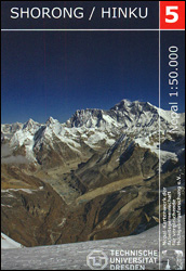
Shorong – Hinku region of Nepal at 1:50,000 on a waterproof and tear-resistant map in the famous Schneider series, revised in 2013 to include extensive tourist information for trekking routes in the area directly south of the Sagarmatha National Park. Centered on Lukla, coverage extends north to Namche Bazaar and south just beyond Kharikhola and the central part the Jiri to Mount Everest trail. Also highlighted is the trail via Kote to the Mera Peak Base Camp and High Camp.Topography is very vividly presented by contours at 40m intervals, enhanced by excellent relief shading and numerous spot heights, plus colouring and/or graphics to show different types of the terrain (glaciers, crevasses, moraine, scree, etc) and vegetation. Highlighting for trekking trails distinguishes between main and secondary routes, and other local routes are marked. A very wide range of symbols indicate various accommodation options, locations with markets or food shops, banks, medical facilities, monasteries and other places of interest, access by air transport, etc. The map has a 2-km UTM grid, plus latitude and longitude margin ticks at 5’ intervals. Map legend is in German and English.To see other titles in the Schenider series, now sponsored by the German Scientific Association of Comparative High-Mountain Research (Arbeitsgemeinschaft fรผr vergleichende Hochgebirgsforschung), please click on the series link.

Related Products:
 Khumbu Himal Schneider Nepal Map 02
 Solu Khumbu – Everest Region Great Himayala Trail Map
 Bhutan Great Himalaya Trail Map
 Paldor Peak
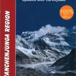 Kanchenjunga Region Great Himalaya Trail Map
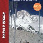 Makalu Region Great Himalay Trail Map
 Mt. Everest (Sagarmatha) – Hinku Himal
 Rara to Khaptad
 Everest Region Trekking Map
 North Annapurna Base Camp
 Rolwaling Region Great Himalaya Trail Map
 Annapurna Base Camp
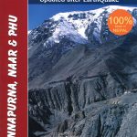 Annapurna, Naar & Phu Great Himalaya Trail Map
 Monastry Circuit Trail
 Kanchenjunga
 Nepal: Himalayan MapHouse Trekking Map 100 Series with the Great Himalaya Trail
 Manaslu & Ganesh Himals Great Himalaya Trail Map
 Helambu Trail
 Nepal – Great Himalaya Trail and National Parks
 Langtang & Helambu Great Himalaya Trail Map
 Nepal: Great Himalaya Trail and National Parks (850K)
 South Downs Way Harvey National Trail XT40
 Numbur Cheese Circuit
 South Loch Ness Trail Harvey National Trail XT40
 Cape Wrath Trail South – Fort William to Strathcarron Harvey National Trail XT40
 Mount Whitney High Country
 Nepal`s Far West – Api & Saipal Himal – Khaptad & Rapa NP – Humla Great Himayala Trail Map
 Helambu – Langtang
 Mustang Great Himalaya Trail Map
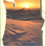 Sisters & Redmond High Desert Trail Map
 Mono Divide High Country
 Dunai to Jumla and Rara Lake
 Pennine Way South Harvey XT40 National Trail Map
 The Essential Guide to London`s Best Food Shops
 The Hermitage (Ruta de l`Ermitร ) Hiking Circuit
 Tumlingtar to Lukla
 Dhaulagiri Circuit
 Chitwan: Chepang Hills Trail
 Langtang and Helambu Trekking Map