Disclosure : This site contains affiliate links to products. We may receive a commission for purchases made through these links.
SHOM Charts for the Channel (Center)

Related Products:
 SHOM Charts for the Channel (West)
 SHOM Charts for North Sea, Pas de Calais, the Channel
 CHS Chart 6441 – West Channel including Anderton Channel, Ministicoog Channel and Moose Channel to Shoalwater Bay
 SHOM Charts for Vanuatu – New Caledonia
 SHOM Charts for French Polynesia
 SHOM Routeing Charts for the Pacific Ocean
 SHOM Routeing Charts for the Atlantic Ocean
 SHOM Charts for Ireland and Western England
 SHOM Charts for the West Coast of France
 SHOM Charts for the Tyrrhenian Sea – Ionian Sea – Adriatic Sea
 SHOM Charts for the Black Sea – Marmara Sea – Mediterranean Sea
 SHOM Charts for the Gulf of Mexico – Caribbean Sea
 SHOM Charts for the Azores – West Coast of Africa
 SHOM Charts for Spain – Portugal – The Strait of Gibraltar – The Alboran Sea
 SHOM Charts for the East Coast of Spain – Balearic Islands
 SHOM Charts for North Africa: Algeria, Tunisia, Libya
 SHOM Charts for the West Coast of Africa – Gulf of Guinea
 SHOM Charts for the Aegean Sea – Greece – Turkey – North Coast of Africa
 SHOM Charts for South Africa – Indian Ocean – Mozambique Canal
 CHS Chart 6437 – Peel Channel including Husky Channel and Phillips Channel
 SHOM Charts for the South West Coast of France – North Coast of Spain
 SHOM Charts for the North East Atlantic, North Sea, Baltic Sea, Mediterranean Sea
 NOAA Charts for Alaska Coast (Planning Charts)
 Tunneling To The Center Of The Earth
 Grande Traversata delle Alpi Center
 Black Forest North and Center Publicpress Cycle Touring 258
 CHS Chart 6428 – Aklavik Channel to Napoiak Channel including Aklavik Channel to Aklavik Kilometre 1530-1597
 Brussels Art Nouveau: Walks in the Center
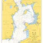 Instructional Chart 5130 – Irish Sea with Saint George`s Channel and North Channel
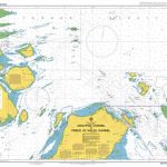 Admiralty Chart AUS292 – Adolphus Channel to Prince of Wales Channel
 Admiralty Chart 1121 – Irish Sea with St George`s Channel and North Channel
 Delphi: A History of the Center of the Ancient World
 CHS Chart 7710 – Lambert Channel and Cache Point Channel
 NOAA Chart 17405 – Ulloa Channel to San Christoval Channel – North Entrance’”Big Salt Lake – Shelter Cove
 Riga City Center Jana Seta Street Plan
 Explorer Charts
 NGA Charts – Region 3
 NGA Charts – Region 4
 NGA Charts – Region 5
 NGA Charts – Region 6


