Disclosure : This site contains affiliate links to products. We may receive a commission for purchases made through these links.
Shipwrecks of the DelMarVa NGS Wall Map ENCAPSULATED

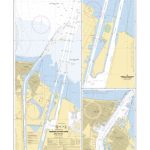
Shipwrecks of the DelMarVa Wall Map, encapsulated version ‘“ size 79 x 89cm (28″ x 35″), from the National Geographic highlighting over 2400 shipwreck locations off the coast of Virginia, Washington DC, Maryland and Delaware from the 17th to the 20th century. The map shows wrecks along the Atlantic coast of the Delmarva Peninsula, as well as in the Delaware Bay, in the Delaware River up to Philadelphia and the Patapsco River up to Baltimore, in the Chesapeake Bay, along the Potomac up to Washington DC, and in the Rappahannock, York and James Rivers. Information includes lists of vessels scuttled by the Confederate forces during the Civil War.This title is part of a series of shipwreck maps from the NGS covering the coastline of the eastern seaboard of Unites States. Each title shows locations of hundreds of wrecks atop beautifully drawn bathymetric and coastal detail. Wreck sites have symbols to define class and type of each vessel, along with its name and, where available, the date of sinking. Coloring indicates whether the vessel was lost in armed conflict or by natural causes. The maps also show locations of lighthouses and life boat stations, and include extensive historical notes. This title is also available on paper without the encapsulation, or in a folded format – please click on the series link for these two options and more titles in this series. With the light blue sea beautifully contrasted against the sepia-coloured land and several lovely historical drawings, these maps are designed to enhance the dรฉcor of any home or office and would look very attractive when framed.LAMINATED and ENCAPSULATED WALL MAPS:- LAMINATED wall maps have a thin layer of plastic usually applied to the printed side only. They can be written on with suitable marker pens without any damage to the map but, unless laminated on both sides, they are not damp-proof.- ENCAPSULATED wall maps are sealed between two sheets of plastic. They are more rigid and heavier than laminated maps of the same size. They are damp-proof and do not crinkle in humid conditions. Encapsulation gives the map a shiny surface, similar to being displayed behind glass.- PLEASE NOTE: many publishers and retailers often use these two terms interchangeably. Our map titles and descriptions follow the definitions provided above.

Related Products:
 Shipwrecks of the DelMarVa
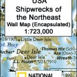 Shipwrecks of the Northeast USA NGS Wall Map ENCAPSULATED
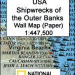
 Shipwrecks of the Outer Banks USA NGS Wall Map ENCAPSULATED
 Shipwrecks of the Northeast USA NGS Wall Map PAPER
 Shipwrecks of the Outer Banks USA NGS Wall Map PAPER
 Shipwrecks of the Northeast USA
 Caribbean NGS Classic Wall Map ENCAPSULATED
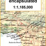 California NGS Wall Map ENCAPSULATED
 Scotland NGS Executive Wall Map ENCAPSULATED
 Milky Way NGS Wall Map ENCAPSULATED
 United States NGS National Parks Wall Map ENCAPSULATED
 Shipwrecks of the Outer Banks USA
 Scotland NGS Classic Wall Map ENCAPSULATED
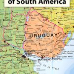
 South America NGS Executive Wall Map ENCAPSULATED
 Canada National Parks NGS Wall Map ENCAPSULATED
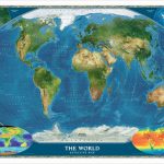 World Satellite Image NGS Wall Map ENCAPSULATED
 Europe Maps International Political Wall Map LARGE ENCAPSULATED
 USA Michelin Political Wall Map ENCAPSULATED
 Iraq NGS Classic Wall Map ENCAPSULATED
 Ireland NGS Classic Wall Map ENCAPSULATED
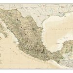
 Mexico NGS Classic Wall Map ENCAPSULATED
 Australasia Political Wall Map: ENCAPSULATED
 South Africa NGS Classic Wall Map ENCAPSULATED
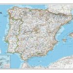 Spain and Portugal NGS Classic Wall Map ENCAPSULATED
 Ireland NGS Executive Wall Map ENCAPSULATED
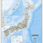 Japan NGS Classic Wall Map ENCAPSULATED
 Italy NGS Classic Wall Map ENCAPSULATED
 Japan NGS Executive Wall Map ENCAPSULATED
 World Hemispheres NGS Wall Map ENCAPSULATED
 Spain and Portugal NGS Executive Wall Map ENCAPSULATED
Italy NGS Executive Wall Map ENCAPSULATED
Spain and Portugal NGS Executive Wall Map ENCAPSULATED
Italy NGS Executive Wall Map ENCAPSULATED
 Mexico NGS Executive Wall Map ENCAPSULATED
 Canada NGS Classic Wall Map ENCAPSULATED
 Africa Maps International Political Wall Map ENCAPSULATED
 Europe Maps International Political Wall Map X-LARGE ENCAPSULATED
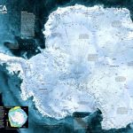 Antarctica NGS Satellite Image Wall Map ENCAPSULATED
Greece NGS Classic Wall Map ENCAPSULATED
Antarctica NGS Satellite Image Wall Map ENCAPSULATED
Greece NGS Classic Wall Map ENCAPSULATED
 Asia Maps International Political Wall Map ENCAPSULATED
 South America Maps International Political Wall Map ENCAPSULATED
 Costa Rica NGS Wall Map ENCAPSULATED