Disclosure : This site contains affiliate links to products. We may receive a commission for purchases made through these links.
Sherborne 1901
Sherborne in 1901 in a fascinating series of reproductions of old Ordnance Survey plans in the Alan Godfrey Editions, ideal for anyone interested in the history of their neighbourhood or family. The town centre is covered, and the map extends eastward to Sherborne Castle. Other features include the Abbey Church, King`s School, station, workhouse, Castleton, remains of old castle, the 16th century Castle, Cheap Street, The Parade, Silk Mill, Newland, Green Hill, part of Nether Coombe, Digby Hotel, etc. A contemporary directory is on the reverse.About the Alan Godfrey Editions of the 25″ OS SeriesSelected towns in Great Britain and Ireland are covered by maps showing the extent of urban development in the last decades of the 19th and early 20th century. The plans have been taken from the Ordnance Survey mapping and reprinted at about 15 inches to one mile (1:4,340). On the reverse most maps have historical notes and many also include extracts from contemporary directories. Most maps cover about one mile (1.6kms) north/south, one and a half miles (2.4kms) across; adjoining sheets can be combined to provide wider coverage.FOR MORE INFORMATION AND A COMPLETE LIST OF ALL AVAILABLE TITLES PLEASE CLICK ON THE SERIES LINK.

Related Products:
 Wickersley 1901
 Rotherham South 1901
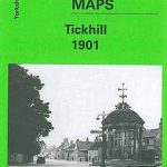 Tickhill 1901
Bolton upon Dearne 1901
Tickhill 1901
Bolton upon Dearne 1901
 Dudley Castle 1901
 Shire Oak and Catshill 1901
Conisbrough 1901
Wollaston 1901 – 4.09
Halesowen (West) 1901 – 4.16
Shire Oak and Catshill 1901
Conisbrough 1901
Wollaston 1901 – 4.09
Halesowen (West) 1901 – 4.16
 Cambridge (North) 1901 – 40.14
Horsehay and Dawley 1901
Bridgnorth 1901
Cambridge (North) 1901 – 40.14
Horsehay and Dawley 1901
Bridgnorth 1901
 Great Britain: Godfrey Editions of Historical Ordnance Survey “A Yard to the Mile” City Plans
Criccieth 1913
Harborne South 1901
Great Britain: Godfrey Editions of Historical Ordnance Survey “A Yard to the Mile” City Plans
Criccieth 1913
Harborne South 1901
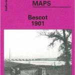 Bescot 1901
Swinton 1901
Newtownards 1901
Blandford Forum 1901
Bangor West 1901
Bescot 1901
Swinton 1901
Newtownards 1901
Blandford Forum 1901
Bangor West 1901
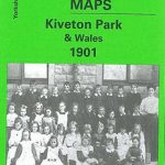 Kiveton Park and Wales 1901
Dundee West 1901
Mexborough 1901
Loughborough 1901
Donaghadee 1901
Bangor East 1901
Dun Laoghaire 1908
Stourport 1901
Barnard Castle 1897 – 52.04a
Dorchester 1901
The Cheviot 1901-13 – 5
Kilnhurst 1901
Ely 1901 – 26.14
Cradley South 1901
Wolverhampton (SW) 1901 – 62.10
Bridport 1901
Kiveton Park and Wales 1901
Dundee West 1901
Mexborough 1901
Loughborough 1901
Donaghadee 1901
Bangor East 1901
Dun Laoghaire 1908
Stourport 1901
Barnard Castle 1897 – 52.04a
Dorchester 1901
The Cheviot 1901-13 – 5
Kilnhurst 1901
Ely 1901 – 26.14
Cradley South 1901
Wolverhampton (SW) 1901 – 62.10
Bridport 1901
 Willenhall (NW) & Wednesfield 1901 – 62.08a
Rothesay 1886 – 204.06
New Quay 1904
Willenhall (NW) & Wednesfield 1901 – 62.08a
Rothesay 1886 – 204.06
New Quay 1904
 Sedgley South-East with Swan Village and West Coseley 1901