Disclosure : This site contains affiliate links to products. We may receive a commission for purchases made through these links.
Severn

Related Products:
 The Severn Way: 210 miles from the River Severn`s source in Powys to the Bristol Channel
 A Sleepwalk on the Severn
 Severn Beach
 The Severn – Arley To Avonmouth
 The Severn – Plynlimon to Bridgnorth
 Waterways Guide 2 – Severn, Avon & Birmingham
 Walks from Bristol`s Severn Beach Line
 South West Sea Kayaking: Isle of Wight to the Severn Estuary
 Pearson`s Canal Companion – Severn and Avon: Mid-Worcestershire Ring and Cotswold Canals
 Stourport-on-Severn: Pioneer Town of the Canal Age
 Severn & Upper Thames 110K Sustrnas Cycle Map No. 11
 Admiralty Chart SC5608_21 – Severn Bridge to Sharpness
 Admiralty Chart SC5608_18 – Avonmouth to Severn Bridge
 Severn, Avon & Birmingham Collins Nicholson Waterways Guide 2
 NOAA Chart 12282 – Chesapeake Bay’”Severn and Magothy Rivers
 CEN309E Trent-Severn Waterway, 2016 – CHS Sailing Directions
 Admiralty Chart 1166 – River Severn Avonmouth to Sharpness
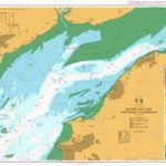
 Admiralty Chart 1176 – Severn Estuary Steep Holm to Avonmouth
 Malvern Hills & Bredon Hill – Tewkesbury, Ledbury, Pershore & Upton upon Severn OS Explorer Map 190 (paper)
 Malvern Hills & Bredon Hill – Tewkesbury, Ledbury, Pershore & Upton upon Severn OS Explorer Active Map 190 (waterproof)


