Disclosure : This site contains affiliate links to products. We may receive a commission for purchases made through these links.
Settle to Carlisle Way Harvey National Trail XT40
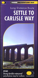
The Settle to Carlisle Way, a 156km (97 miles) long-distance hiking route which follows the famous railway line presented in seven sections at 1:40,000 on GPS compatible, light, waterproof and tear-resistant map from Harvey Map Services. Each panel shows the trail and the surrounding countryside on mapping with contours at 15m intervals and colouring to indicate different types of vegetation. The overprint for the route (which has no special waymarking other than the usual public footpath or bridleway signs) indicates sections on track, on path, on indistinct path, where there is no visible path, and on or crossing roads which require special care. Symbols mark locations of various facilities including youth hostels, bunkhouses, campsites, food shops, pubs, tourist attractions, etc. The panels have the lines of the British National grid at 1km intervals. The map includes historical information about this most scenic of England’s railway lines, tourist tips, and other useful information including contact addresses/phone numbers.To see other titles in this series please click on the series link.


