Disclosure : This site contains affiliate links to products. We may receive a commission for purchases made through these links.
Serra Tramuntana 2-Map Set

Serra Tramuntana, the mountains of north-west Mallorca, on a set of two double-sided, contoured, GPS compatible hiking maps at 1:35,000 from Map Solutions printed on light, waterproof and tear-resistant synthetic paper.Excellently presented topographic base has contours at 20m intervals with plenty of spot heights and names of peaks and other topographic features, plus coloring for woodlands. An overprint highlights waymarked hiking paths, indicating more difficult climbing sections and routes which are part of the GR221 and GR222 long-distance trails. Road network indicates bus connections and for drivers shows car parks and locations of petrol supplies. Railway lines are shown with stations.Symbols show various types of accommodation including mountain huts and refuges and agrotourism farms, selected restaurants, places of interest, etc. The maps have UTM margin ticks. Map legend includes English. Also provided is a glossary of Catalan terms useful for hikers.

Related Products:
 Serra de Tramuntana Editorial Alpina 4-Map Set
Mallorca – Serra de Tramuntana South Publicpress Hiking 428
Mallorca – Serra de Tramuntana North Publicpress Hiking 427
Serra de Tramuntana Editorial Alpina 4-Map Set
Mallorca – Serra de Tramuntana South Publicpress Hiking 428
Mallorca – Serra de Tramuntana North Publicpress Hiking 427
 Taga – Serra Cavallera Editorial Alpina
 Serra del Cadรญ – Pedraforca Editorial Alpina
 Serra d`Irta Natural Park – Columbretes Islands
 Marina Baixa – Serra d`Aitana Editorial Piolet
 Serra de Bernia – Marina Alta Editorial Piolet
Mallorca – Serra de Tramuntana
Serra de Bernia – Marina Alta Editorial Piolet
Mallorca – Serra de Tramuntana
 Serra de Pร ndols and Serra de Cavalls
 A Serra de Outes CNIG Topo 93
 Mallorca – Tramuntana North Editorial Alpina
Serra de Boumort – 2-Map Set
Mallorca – Tramuntana North Editorial Alpina
Serra de Boumort – 2-Map Set
 Serra de Miramar
 Mallorca – Tramuntana South Editorial Alpina
 Mallorca – Tramuntana Central Editorial Alpina
 Bergueda: Berga – Serra del Cadรญ Ed. Alpina Paragliding Map
Serra de Montsant
Bergueda: Berga – Serra del Cadรญ Ed. Alpina Paragliding Map
Serra de Montsant
 Serra de Llaberia Editorial Piolet
 Serra da Estrela Nature Park
 Organyร -Boumort – Serra de Taรบs
Tremp – la Pobla de Segur – Serra de Boumort – Isona
Organyร -Boumort – Serra de Taรบs
Tremp – la Pobla de Segur – Serra de Boumort – Isona
 San Marcos da Serra
 Ukraine Kartografija Road Atlas 500K HARDBACK
Ukraine Road Atlas (500K, Spiral-bound)
Ukraine Kartografija Road Atlas 500K HARDBACK
Ukraine Road Atlas (500K, Spiral-bound)
 Rasos de Peguera – Serra d`Ensija Editorial Alpina
 Jordan
 Slovakia Road Atlas
 Delta of the Ebro ‘“ Serra de Montsiร Editorial Alpina
 Bratislava – Slovakia
 Dalmatia 2-Map Set
 Lithuania: Jana Seta 200K/250K Regional Touring Maps
 Saldus and its Vicinity Jana Seta Map
 Kuldiga and its Vicinity Jana Seta Map
 Valmieras and its Vicinity Jana Seta Map
 Vall de Lord – Port del Comte Editorial Alpina
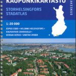 Helsinki Region Street Atlas
 Ventspils and its Vicinity Jana Seta Map
 Finland Road Atlas GLOVEBOX, SPIRAL-BOUND
 Mexico Pacific Coast & Guadalajara ITMB