Disclosure : This site contains affiliate links to products. We may receive a commission for purchases made through these links.
Serra del Cadรญ – Pedraforca Editorial Alpina
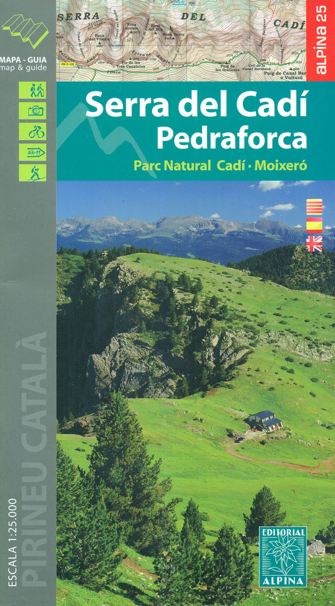
Serra del Cadรญ – Pedraforca area of the eastern Pyrenees in Spain, including the Cadรญ ‘“ Moixerรณ Natural Park, presented on a contoured and GPS compatible map at 1:25,000 from Editorial Alpina. The map has contours at 10m intervals, enhanced by relief shading with plenty of spot heights, plus colouring for different types of vegetation and/or land use. An overprint highlights walking paths, indicating where appropriate their PR or GR numbers. Symbols show various types of accommodation (hotels, farms, refuges, campsites, etc), picturesque locations, recreational sites (climbing, canyoning, etc), and other places of interest. Local roads indicate car parks and locations of petrol stations. The map has a 1km UTM grid. Map legend includes English. Accompanying booklet with 29 pages in English provides descriptions of 17 recommended walking trails, 9 more strenuous ascents, 5 mountain bike routes, other recreational recommendations, an extensive list of contact details for local accommodation, etc.To see the list of currently available titles in this extensive Editorial Alpina hiking series please click on the series link.

Related Products:
 Serra de Tramuntana Editorial Alpina 4-Map Set
 Montgrony – Fonts del Llogregat – Parc Natural del Cadรญ-Moixerรฒ Editorial Alpina
 Serralada de Marina Editorial Alpina
 Taga – Serra Cavallera Editorial Alpina
 Moixerรณ – La Tosa – Cadรญ-Moixerรณ Natural Park Editorial Alpina
 Bergueda: Berga – Serra del Cadรญ Ed. Alpina Paragliding Map
Cotiella ‘“ Peรฑa Montaรฑesa Editorial Alpina
Bergueda: Berga – Serra del Cadรญ Ed. Alpina Paragliding Map
Cotiella ‘“ Peรฑa Montaรฑesa Editorial Alpina
 Rasos de Peguera – Serra d`Ensija Editorial Alpina
 Mallorca – Tramuntana Central Editorial Alpina
 Alt Pirineu Natural Park Editorial Alpina
Bachimala – Valles de Chistau y Bielsa Editorial Alpina
Alt Pirineu Natural Park Editorial Alpina
Bachimala – Valles de Chistau y Bielsa Editorial Alpina
 Posets-Maladeta Natural Park 2-Map Set Editorial Alpina
 Mallorca – Tramuntana South Editorial Alpina
 Mallorca – Tramuntana North Editorial Alpina
 Sierra Nevada – La Alpujarra Editorial Alpina
 Valles de Ansรณ & Echo Editorial Alpina
 Andorra – Comapedrosa – Engorgs – Jucla – Pessons – Tristaina Editorial Alpina
 Valles de Belagua y Roncal Editorial Alpina
 Delta of the Ebro ‘“ Serra de Montsiร Editorial Alpina
 Aneto – Maladeta – PN Posets Editorial Alpina
 Vall de Lord – Port del Comte Editorial Alpina
 Sant Maurici Editorial Alpina
 Valle de Benasque Editorial Alpina
Ordesa – Monte Perdido National Park Editorial Alpina 2-Map Set
Vall de Boรญ – Aigรผestortes PN Editorial Alpina
Valle de Benasque Editorial Alpina
Ordesa – Monte Perdido National Park Editorial Alpina 2-Map Set
Vall de Boรญ – Aigรผestortes PN Editorial Alpina
 El Turbรณn ‘“ Alto Valle de Isรกbena Editorial Alpina
 Ordesa and Monte Perdido National Park 2-Map Set Editorial Alpina
Ordesa and Monte Perdido National Park Editorial Alpina
Cingles de Berti – Sant Miquel des Fai Editorial Alpina
Ordesa and Monte Perdido National Park 2-Map Set Editorial Alpina
Ordesa and Monte Perdido National Park Editorial Alpina
Cingles de Berti – Sant Miquel des Fai Editorial Alpina
 Macizo de Monte Perdido – Valle de Ordesa – Pineta Editorial Alpina
Sobrarbe Central – Ainsa – Boltana Editorial Alpina
Macizo de Monte Perdido – Valle de Ordesa – Pineta Editorial Alpina
Sobrarbe Central – Ainsa – Boltana Editorial Alpina
 Puigmal – Vall de Nuria – Ulldeter Editorial Alpina
 Cavalls del Vent – Cadi-Moixero Natural Park Hiking Circuit Editorial Alpina
Aigรผestortes and Estany de Sant Maurici National Park 2-Map Set Editorial Alpina
Cavalls del Vent – Cadi-Moixero Natural Park Hiking Circuit Editorial Alpina
Aigรผestortes and Estany de Sant Maurici National Park 2-Map Set Editorial Alpina
 Alta Garrotxa – Comanegra – Bassegoda – el Mont Editorial Alpina
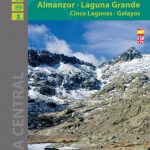 Sierra de Gredos – Almanzor – Laguna Grande Editorial Alpina
Garraf – la Morella – Eramprunya Editorial Alpina
Sierra de Gredos – Almanzor – Laguna Grande Editorial Alpina
Garraf – la Morella – Eramprunya Editorial Alpina
 Muntanya d’Alinyร Editorial Alpina
Sant Llorenc del Munt i l`Obac Editorial Alpina
Muntanya d’Alinyร Editorial Alpina
Sant Llorenc del Munt i l`Obac Editorial Alpina