Disclosure : This site contains affiliate links to products. We may receive a commission for purchases made through these links.
Serra de Tramuntana Editorial Alpina 4-Map Set
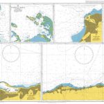
Mallorca’s Serra de Tramuntana mountains presented by Editorial Alpina at 1:25,000 on a set of two light, waterproof and tear-resistant, contoured and GPS compatible, double-sided maps with an overprint for local hiking trails, GR221 long-distance route, sites for various outdoor activities, accommodation options, etc. Coverage extends from Andratx to Cap de Formentor and Alcรบcida.The maps have contours at 10m intervals, relief shading and numerous spot heights, plus colouring to show different types of vegetation. An overprint highlights walking trails, indicating routes which are not waymarked and/or steep and difficult to follow. Symbols show locations of mountain refuges, campsites and other accommodation, climbing and canyoning sites, etc. Road network indicates car parks, petrol stations and local bus stops. An enlargement shows the Sanctuari de Lluc area in greater detail at 1:10,000. The maps have a 1-km UTM grid plus latitude and longitude margin ticks at 1’ intervals. Map legend includes English.PLEASE NOTE: unlike most Editorial Alpina titles, this set contains only maps without an accompanying booklet with descriptions of recommended hiking trails, etc. The same cartography is used by Editorial Alpina in their selection of several other titles covering the Mallorca’s mountains. To see the list of all the titles in Editorial Alpina’s extensive series of walking maps of Spain, including more titles covering Mallorca, please click on the series link.

Related Products:
 Mallorca – Tramuntana Central Editorial Alpina
 Mallorca – Tramuntana South Editorial Alpina
 Mallorca – Tramuntana North Editorial Alpina
 Serra del Cadรญ – Pedraforca Editorial Alpina
 Rasos de Peguera – Serra d`Ensija Editorial Alpina
 Taga – Serra Cavallera Editorial Alpina
 Delta of the Ebro ‘“ Serra de Montsiร Editorial Alpina
 Caps del Nord – Mallorca Editorial Alpina 2-Map Set
 Mallorca North Walking & Cycling Map & Guide Editorial Alpina
 Spain: Editorial Alpina Walking Maps
 Vall de Lord – Port del Comte Editorial Alpina
Vall de Barravรฉs – Ribagorรงa Editorial Alpina
Vall de Lord – Port del Comte Editorial Alpina
Vall de Barravรฉs – Ribagorรงa Editorial Alpina
 Valles de Irati y Aezkoa Editorial Alpina
Sierra Nevada – La Alpujarra Editorial Alpina
Valles de Irati y Aezkoa Editorial Alpina
Sierra Nevada – La Alpujarra Editorial Alpina
 Valles de Ansรณ & Echo Editorial Alpina
 Valles de Belagua y Roncal Editorial Alpina
 Sant Maurici Editorial Alpina
 Congost de Mont-rebei Editorial Alpina
Val d`Aran by UTMB Editorial Alpina Trail running race Map
Cingles de Berti – Sant Miquel des Fai Editorial Alpina
Val d`Aran – Mauberme – Montardo – Molieres Editorial Alpina
Sant Llorenc del Munt i l`Obac Editorial Alpina
Puigsacalm – Bellmunt Editorial Alpina
Congost de Mont-rebei Editorial Alpina
Val d`Aran by UTMB Editorial Alpina Trail running race Map
Cingles de Berti – Sant Miquel des Fai Editorial Alpina
Val d`Aran – Mauberme – Montardo – Molieres Editorial Alpina
Sant Llorenc del Munt i l`Obac Editorial Alpina
Puigsacalm – Bellmunt Editorial Alpina
 Montseny NP – Turo de l`Home – Les Agudas – Matagalls – la Calma Editorial Alpina 2-Map Set
Vall de Boรญ – Aigรผestortes PN Editorial Alpina
Montseny NP – Turo de l`Home – Les Agudas – Matagalls – la Calma Editorial Alpina 2-Map Set
Vall de Boรญ – Aigรผestortes PN Editorial Alpina
 Catllarร s – Picancel Editorial Alpina
 El Turbรณn ‘“ Alto Valle de Isรกbena Editorial Alpina
Garraf – la Morella – Eramprunya Editorial Alpina
El Turbรณn ‘“ Alto Valle de Isรกbena Editorial Alpina
Garraf – la Morella – Eramprunya Editorial Alpina
 Valle de Benasque Editorial Alpina
 Montseny Editorial Alpina
Aigรผestortes and Estany de Sant Maurici National Park 2-Map Set Editorial Alpina
Montseny Editorial Alpina
Aigรผestortes and Estany de Sant Maurici National Park 2-Map Set Editorial Alpina
 Guadarrama – La Pedriza 2-Map Set Editorial Alpina
 Montgrony – Fonts del Llogregat – Parc Natural del Cadรญ-Moixerรฒ Editorial Alpina
 Puigmal – Vall de Nuria – Ulldeter Editorial Alpina
 Valle de Canfranc – Valle de Aisa – Candanchu – Astun Editorial Alpina
 Posets-Maladeta Natural Park 2-Map Set Editorial Alpina
Alt Empordรก 2-Map Set Editorial Alpina
Posets-Maladeta Natural Park 2-Map Set Editorial Alpina
Alt Empordรก 2-Map Set Editorial Alpina
 Ripollรจs Editorial Alpina
 Costabona – Alta Val de Ter Editorial Alpina
 Muntanya d’Alinyร Editorial Alpina