Disclosure : This site contains affiliate links to products. We may receive a commission for purchases made through these links.
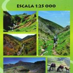
Serra de Pร ndols and Serra de Cavalls
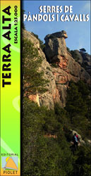
Sierras de Pร ndols and Sierra de Cavalls near Gandesa in southern Catalonia on a contoured and GPS compatible map at 1:25,000 from Editorial Piolet, highlighting recommended hiking routes and climbing sites, as well as locations connected with the Battle of Ebro, the longest and the bloodiest battle of the Spanish Civil War. On the reverse there are route profiles of three hiking circuits from Gandesa (17, 24.5 and 33km long) and a list of 50 climbing locations with grading. Map legend includes English. The text on the reverse side is in Catalan only.Hiking maps in the Editorial Piolet series, unless indicated to the contrary in the individual description, have contours at 10m intervals, enhanced by relief shading and/or altitude colouring, and provide very detailed presentation of the terrain and local road network. An overprint highlights hiking routes, distinguishing between short local routes, longer PR paths and long-distance GR routes. Symbols mark campsites and mountain huts or refuges, various places of interest, climbing or other recreational areas, etc. Each title has a UTM grid. Map legend includes English.

Related Products:
 Serra de Llaberia Editorial Piolet
 Serra de Bernia – Marina Alta Editorial Piolet
 Marina Baixa – Serra d`Aitana Editorial Piolet
Serra de Montsant
Marina Baixa – Serra d`Aitana Editorial Piolet
Serra de Montsant
 Geoparque de las Sierras Subbeticas Editorial Piolet
Serra de Boumort – 2-Map Set
Geoparque de las Sierras Subbeticas Editorial Piolet
Serra de Boumort – 2-Map Set
 Serra de Miramar
El Moncayo Editorial Piolet
Siurana
Muntanyes de Prades Sud: Walks from l`Albiol
Serra de Miramar
El Moncayo Editorial Piolet
Siurana
Muntanyes de Prades Sud: Walks from l`Albiol
 Cami de l`Ossa – Andorra Editorial Piolet
Spain: Editorial Piolet Hiking Maps
Cami de l`Ossa – Andorra Editorial Piolet
Spain: Editorial Piolet Hiking Maps
 Menorca – Camรญ de Cavalls – GR223 Editorial Alpina CATALAN
 La Ruta del Caracremada Editorial Piolet
Montsec de L`Estall
La Ruta del Caracremada Editorial Piolet
Montsec de L`Estall
 Menorca – Camรญ de Cavalls – GR223 Editorial Alpina ENGLISH
Calblanque, Monte de las Cenizas and Peรฑa del Aguila Regional Park
El Moianรจs
Menorca – Camรญ de Cavalls – GR223 Editorial Alpina ENGLISH
Calblanque, Monte de las Cenizas and Peรฑa del Aguila Regional Park
El Moianรจs
 Val de Toran
 Tarragona and Environs (Camins del Camp – Costa Nord)
Muntanyes de Prades
El Collsacabra
Sierra de la Pila Regional Park
Tarragona and Environs (Camins del Camp – Costa Nord)
Muntanyes de Prades
El Collsacabra
Sierra de la Pila Regional Park
 El Ports 2-map Set
Sierra Nevada – the Traverse at 3000m Editorial Piolet
Sierra de Bรฉjar
Parc del Foix ‘“ Parc d’Olรจrdola
El Ports 2-map Set
Sierra Nevada – the Traverse at 3000m Editorial Piolet
Sierra de Bรฉjar
Parc del Foix ‘“ Parc d’Olรจrdola
 Serra de Tramuntana Editorial Alpina 4-Map Set
 From l`Ametlla de Mar to l`Ampolla
Caรฑรณn del Rรญo Lobos Natural Park
L`Ardenya – Massis de Cadiretes
Muntanyes de Vandellรฒs
From l`Ametlla de Mar to l`Ampolla
Caรฑรณn del Rรญo Lobos Natural Park
L`Ardenya – Massis de Cadiretes
Muntanyes de Vandellรฒs
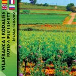 Villafranca del Penedรจs and Environs (Camins de l`Alt Penedes)
 Rasos de Peguera – Serra d`Ensija Editorial Alpina
 Urbion – Viniegras and Sierra de Castejon
La Laguna Negra ‘“ Picos de Urbiรณn
Urbion – Viniegras and Sierra de Castejon
La Laguna Negra ‘“ Picos de Urbiรณn
 El Ports: Southern Stars Long-distance Hiking Route
 Taga – Serra Cavallera Editorial Alpina
 Val d`Aran: Setau Sagรจth Hiking Circuit
 Serra del Cadรญ – Pedraforca Editorial Alpina