Disclosure : This site contains affiliate links to products. We may receive a commission for purchases made through these links.
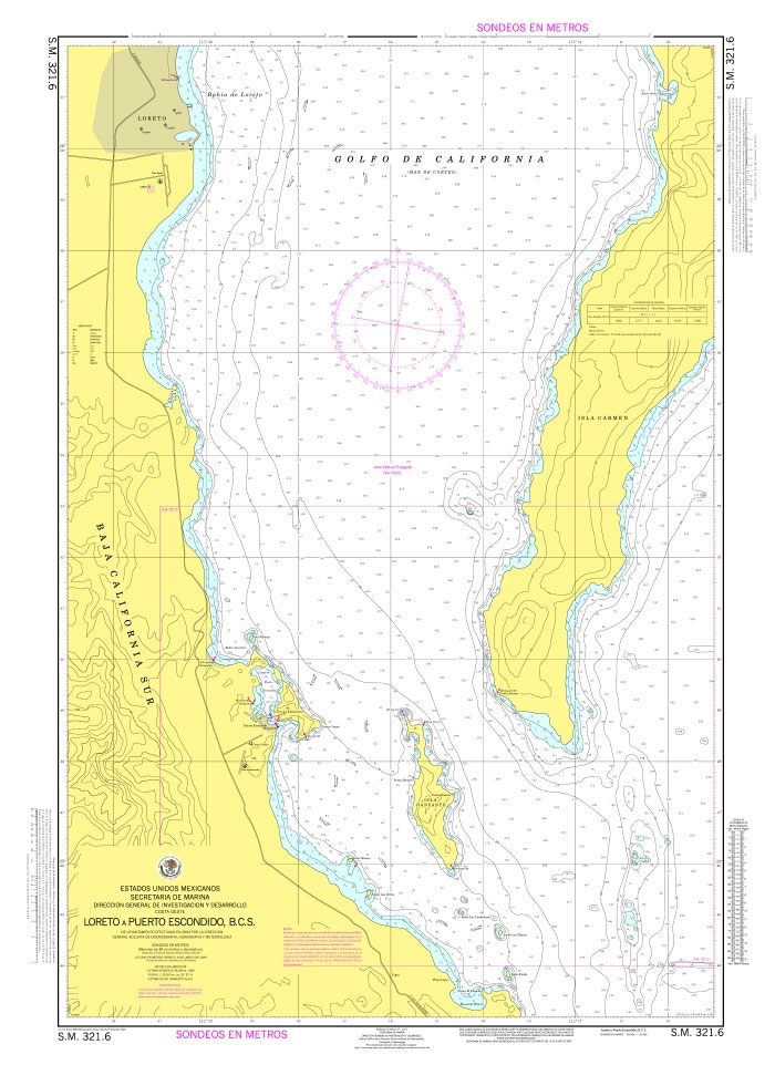
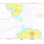
SEMAR Chart 321.6 – Loreto to Puerto Escondido, Baja California Sur
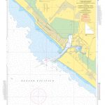
Official Mexican Hydrographic Office charts (SEMAR – Secretarรญa de Marina Armada de Mรฉxico) offer a great range of scales for ports along the Mexico`s Pacific coast. Available to order from Stanfords. Also available: – General and Regional charts of Mexico – Charts for ports along the Gulf of Mexico and the Caribbean coast For more information, please email maritime@stanfords.co.uk .

Related Products:
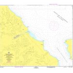
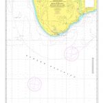
 SEMAR Chart 321.3 – Puerto Escondido, Baja California Sur
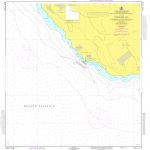
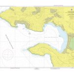
 SEMAR Chart 321.7 – Portulano Loreto, Baja California Sur
 SEMAR Chart 341.2 – Puerto San Carlos, Baja California Sur
SEMAR Chart 342.2 – Puerto Cortes, Baja California Sur (Bahia las Almejas)
SEMAR Chart 341.2 – Puerto San Carlos, Baja California Sur
SEMAR Chart 342.2 – Puerto Cortes, Baja California Sur (Bahia las Almejas)
 SEMAR Chart 232.2 – Mulege, Baja California Sur
SEMAR Chart 621.2 – Puerto Escondido, Oaxaca
SEMAR Chart 232.2 – Mulege, Baja California Sur
SEMAR Chart 621.2 – Puerto Escondido, Oaxaca
 SEMAR Chart 342 – Cabo San Lazaro to Isla Creciente, Baja California Sur
SEMAR Chart 111.2 – El Rosarito, Baja California
SEMAR Chart 111.4 – El Sauzal, Baja California
SEMAR Chart 342 – Cabo San Lazaro to Isla Creciente, Baja California Sur
SEMAR Chart 111.2 – El Rosarito, Baja California
SEMAR Chart 111.4 – El Sauzal, Baja California
 SEMAR Chart 111.6 – Ensenada, Baja California
 SEMAR Chart 111.8 – Costa Azul , Baja California
SEMAR Chart 141.3 – Laguna Ojo de Liebre, Baja California
SEMAR Chart 211.1 – Bahia San Felipe, Baja California
SEMAR Chart 142.6 – Bahia Tortugas, Baja California Sur
SEMAR Chart 111.8 – Costa Azul , Baja California
SEMAR Chart 141.3 – Laguna Ojo de Liebre, Baja California
SEMAR Chart 211.1 – Bahia San Felipe, Baja California
SEMAR Chart 142.6 – Bahia Tortugas, Baja California Sur
 SEMAR Chart 231.3 – Santa Rosalia, Baja California Sur
 SEMAR Chart 323.5 – Canal de San Lorenzo, Baja California Sur
SEMAR Chart 352.1 – Bahia de San Lucas, Baja California Sur
SEMAR Chart 323.5 – Canal de San Lorenzo, Baja California Sur
SEMAR Chart 352.1 – Bahia de San Lucas, Baja California Sur
 SEMAR Chart 352.1A – Cabo de San Lucas, Baja California Sur
SEMAR Chart 352.2 – San Jose del Cabo, Baja California Sur
SEMAR Chart 352.1A – Cabo de San Lucas, Baja California Sur
SEMAR Chart 352.2 – San Jose del Cabo, Baja California Sur
 SEMAR Chart 111.5 – Bahia de Todos Santos, Baja California
SEMAR Chart 121.1 – Bahia Santa Maria, Baja California
SEMAR Chart 133.2 – Bahia Santa Rosalita, Baja California
SEMAR Chart 111.5 – Bahia de Todos Santos, Baja California
SEMAR Chart 121.1 – Bahia Santa Maria, Baja California
SEMAR Chart 133.2 – Bahia Santa Rosalita, Baja California
 SEMAR Chart 232.1 – Bahia Santa Ines, Baja California Sur
SEMAR Chart 211.2 – Bahia San Felipe to Punta Diggs, Baja California
SEMAR Chart 232.1 – Bahia Santa Ines, Baja California Sur
SEMAR Chart 211.2 – Bahia San Felipe to Punta Diggs, Baja California
 SEMAR Chart 352 – Banco Golden Gate to Bahia San Jose del Cabo, Baja California Sur
 SEMAR Chart 200 – California Gulf, Northern Part
SEMAR Chart 722.3 – Rio Panuco – Puerto de Tampico
SEMAR Chart 711.3 – Puerto de Matamoros, Tamaulipas (El Mezquital)
SEMAR Chart 200 – California Gulf, Northern Part
SEMAR Chart 722.3 – Rio Panuco – Puerto de Tampico
SEMAR Chart 711.3 – Puerto de Matamoros, Tamaulipas (El Mezquital)
 SEMAR Chart 722.2 – Puerto de Altamira
 SEMAR Chart 523.4 – Puerto Marquez
 SEMAR Chart 634.1 – Puerto Chiapas
SEMAR Chart 821.2 – Veracruz to Puerto de Alvarado
SEMAR Chart 010 – Ensenada to Mazatlan, Including California Gulf
SEMAR Chart 214.1 – Puerto Penasco and Approaches
SEMAR Chart 522.1 – Puerto Vicente Guerrero
SEMAR Chart 634.1 – Puerto Chiapas
SEMAR Chart 821.2 – Veracruz to Puerto de Alvarado
SEMAR Chart 010 – Ensenada to Mazatlan, Including California Gulf
SEMAR Chart 214.1 – Puerto Penasco and Approaches
SEMAR Chart 522.1 – Puerto Vicente Guerrero