Disclosure : This site contains affiliate links to products. We may receive a commission for purchases made through these links.
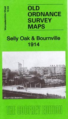
Selly Oak & Bournville 1914: Worcestershire Sheet 10.04b

Related Products:
 Selly Oak and Bournville 1903
 Stourbridge (South) & Oldwinsford: Worcestershire Sheet 4.14a
 Droitwich (North) 1901: Worcestershire Sheet 22.14
 Droitwich (South) 1902: Worcestershire Sheet 29.02
 Tipton 1914: Staffordshire Sheet 67.08b
 Dudley 1914: Staffordshire Sheet 67.16c
 Round Oak 1914: Staffordshire Sheet 71.03b
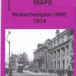 Wolverhampton (NW) 1914: Staffordshire Sheet 62.06b
 Edgbaston 1914: Warwickshire Sheet 13.12c
 Harborne 1914: Warwickshire Sheet 13.11b
 Felling 1914: Tyneside Sheet 24B
 Blaydon & Stella 1914: Tyneside Sheet 28b
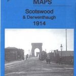 Scotswood & Derwenthaugh 1914: Tyneside Sheet 26b
 Netherton & Springfield 1914: Staffordshire Sheet 71.04b
 Whiteheath Gate 1914: Staffordshire Sheet 72.01
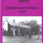 Old Benwell & Denton 1914: Tyneside Sheet 29b
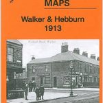 Walker & Hebburn 1914: Tyneside Sheet 13b
 Bournbrook & Birmingham University 1914: Warwickshire Sheet 13.16b
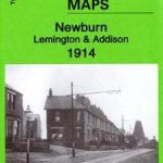 Newburn, Lemington & Addison 1914: Tyneside Sheet 25b
 Gateshead South (Bensham, Teams & Shipcote) 1914: Tyneside Sheet 23b
Lifford and Bournville 1903
Gateshead South (Bensham, Teams & Shipcote) 1914: Tyneside Sheet 23b
Lifford and Bournville 1903
 Leadhills: Brief Sheet Explanation for 1: 50 000 Scale Geology Map, Sheet S15e (Scotland)
 Worcestershire
 Worcestershire Pevsner Architectural Guide
 Herefordshire, Worcestershire & North Gloucestershire 110K Sustrans Cycle Map No. 15
 Pearson`s Canal Companion – Severn and Avon: Mid-Worcestershire Ring and Cotswold Canals
 Maesteg 1914 – 26.09
 Nantyffyllon 1914 – 26.05
 Aberavon 1914 – 25.13
 Brimington 1914 – 18.15
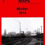 Murton 1914 – 21.06
 Darlington 1914 – 55.06b
 Wolverhampton SW 1914 – 62.10b
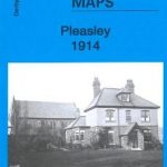 Pleasley 1914 – 31.07
 Low Fell 1914 – 6.08b
 Penrhiwceiber & Tynetown 1914 – 19.10
 Whittington Moor 1914 – 18.14
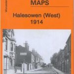 Halesowen (West) 1914 – 4.16b
 Stockton (North) 1914 – 50.12b
 Mansfield Woodhouse 1914 – 23.09