Disclosure : This site contains affiliate links to products. We may receive a commission for purchases made through these links.
Seeland / Trois Lacs
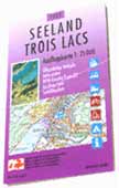
Second edition of a special map originally produced by the Swiss national survey organisation for the Expo01. The map is a photographic enlargement of the Swiss topographic survey at 1:100,000 and covers the area around the four main venues: Neuchร
: tel, Biel/Bienne, Yverdon-les-Bains and Murten, extending east to include Fribourg and Berne. The map carries extensive tourist information: railways, bus routes and ferry lines are cross-referenced to the national timetable; bus routes are highlighted and show bus stops; national and regional cycle routes are indicated, as well as cycle hire facilities; etc.On the reverse, there is an index, a general road map of Switzerland, a distance table, and a panorama of the Alps as seen from Mont Vully near Murten.


