Disclosure : This site contains affiliate links to products. We may receive a commission for purchases made through these links.
Seaworthy Panama Cruising Guide 2nd Edition
Explorer Chartbook Exumas and the Ragged Islands (9th Edition) presents the chart coverage of the central cruising ground of the Bahamas. For this edition, these Exuma charts have been digitally redrawn to pinpoint accuracy using aerial photographs. You`ll notice border scales, new and corrected data, depth contours, updated variation, chart page overlaps, and notes on “Joins page…” They have conducted new surveys in many areas, especially most extensively in the Ragged Island chain.Special features include: ‘
: 66 cruiser-friendly Explorer Charts’
: On-scene GPS way points and routes’
: The most up-to-date and complete source of information on services and facilities’
: WGS 84 datum, extensive hydrographic and topographical features to scale’
: One-minute grid and border scales’
: Tide Tables’
: Latest table of recommended marinas and services for all of the Bahamas Printed on water-and tear-resistant Polyart.

Related Products:
 Explorer Chartbook Exumas Ragged Islands 9TH ED
 Explorer Chartbook Far Bahamas 7th Edition
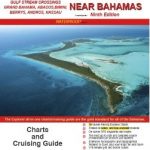 Explorer Chartbook Near Bahamas 9th Edition
 Seaworthy Cruising Guide to The Turks and Caicos Islands, 3rd Edition
 A Cruising Guide to: The Southern Bahamas
 The Panama Cruising Guide
 The Panama Guide: A Cruising Guide to the Isthmus of Panama
 US Pacific Coast – Charlie`s Charts Cruising Guide
 A Cruising Guide to: The Northern Bahamas
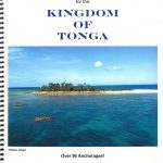 Cruising Guide For The Kingdom Of Tonga
 Cruising Guide Abaco Bahamas 2018
 Cruising Guide to the Northern Leeward Islands 2018/2019
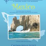 Western Mexico – Charlie`s Charts Cruising Guide
 Explorer Chart – Bahamas Overview
 North to Alaska – Charlie`s Charts Cruising Guide – 5th Edition
Admiralty Chart 8006 – Panama Canal, Northern Entrance Port Approach Guide
Admiralty Chart 8007 – Panama Canal, Southern Entrance Port Approach Guide
North to Alaska – Charlie`s Charts Cruising Guide – 5th Edition
Admiralty Chart 8006 – Panama Canal, Northern Entrance Port Approach Guide
Admiralty Chart 8007 – Panama Canal, Southern Entrance Port Approach Guide
 The Rough Guide to Panama
 A Cruising Guide to the Windward Islands
 Cruising Guide to the Southern Leeward Islands 2020/21
 Cruising Guide to the Virgin Islands
 Waterway Guide Bahamas 2021
 Indian Ocean Cruising Guide
 A Cruising Guide to Puerto Rico
 Cruising Guide To Venezuela & Bonaire
 Waggoner Cruising Guide 2021
 Admiralty Chart 1929 – Gulf of Panama
 Polynesia – Charlie`s Charts Cruising Guide 8th Edition
 Polynesia – Charlie`s Charts Cruising Guide SUPERCEDED
 Southern California – Charlie`s Charts Cruising Guide
 Admiralty Chart CP4 – Panama Canal Gaillard Cut
 Admiralty Chart CP5 – Panama Canal Pacific Entrance
 Admiralty Chart 2258 – Bahia Buenaventura to Panama
 Maldives Cruising Guide
 SHOM Chart 6964 – De Panama au Cap Horn (Cรขbo de Hornos)
Admiralty Chart CP2 – Panama Canal North Gatun Lake
Admiralty Chart CP3 – Panama Canal South Gatun Lake
Admiralty Chart CP1 – Panama Canal Atlantic Entrance and adjacent Ports
SHOM Chart 6964 – De Panama au Cap Horn (Cรขbo de Hornos)
Admiralty Chart CP2 – Panama Canal North Gatun Lake
Admiralty Chart CP3 – Panama Canal South Gatun Lake
Admiralty Chart CP1 – Panama Canal Atlantic Entrance and adjacent Ports
 Canning Stock Route Design Interaction Guide
 Reg 9.3 Bahamas Southeast