Disclosure : This site contains affiliate links to products. We may receive a commission for purchases made through these links.
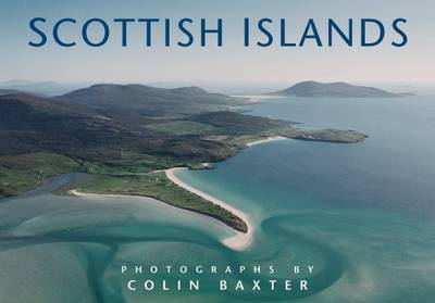
Scottish Islands

Related Products:
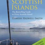 The Scottish Islands: The Bestselling Guide to Every Scottish Island
 The Hebrides: By the presenter of BBC TV`s Grand Tours of the Scottish Islands
 Scottish Island Bagging: The Walkhighlands Guide to the Islands of Scotland
 Mountain Stories: Remembered journeys in the Scottish Highlands and Islands
 The Rough Guide to the Scottish Highlands & Islands (Travel Guide with Free eBook)
 The Scottish Nationality Test 2014/15: How Scottish are You?
 Gulf Islands – Nanaimo and Islands ITMB
 Scottish Highlands c.1900
 Scottish Rock Volume 2 – North: 2
 Chasing the Ephemeral: 50 Routes for a Successful Scottish Winter
 The Cyclist`s Guide to Hillclimbs on Scottish Highland Roads
 Lanarkshire & Scottish Borders 110K Sustrans Cycle Map No. 38
 John O`Groats & North Scottish Coast Cycle Map
 North Northumberland & Scottish Borders Sustrans Cycle Map 39
 The Great Mountain Crags of Scotland: A Celebration of Scottish Mountaineering
 Skye – the Cuillin: Scottish Mountaineering Club Climbers` Guide
 Skye Sea-cliffs and Outcrops: Scottish Mountaineering Club Climbers` Guide
 NGA Chart 81145 – Palau Islands Northern Part [West Caroline Islands]
 Naxos Theseus & Ariadne Greek Islands: All You Need to Know About the Islands Myths, Legends, and its Gods
 Iberian Peninsula – Balearic Islands – Canary Islands CNIG Physical Wall Map
 NOAA Chart 16540 – Shumagin Islands to Sanak Islands – Mist Harbor
 Admiralty Chart 4629 – Samoa Islands to Northern Cook Islands and Tokelau
 NGA Chart 81329 – Eten Anchorage [Caroline Islands – Truk Islands]
Admiralty Chart 4630 – Samoa Islands to Southern Cook Islands
NGA Chart 81329 – Eten Anchorage [Caroline Islands – Truk Islands]
Admiralty Chart 4630 – Samoa Islands to Southern Cook Islands
 Treasured Islands: The explorer`s guide to over 200 of the most beautiful and intriguing islands around Britain
 Admiralty Chart 3200 – Falkland Islands to South Sandwich Islands and Graham Land
 Scottish Rock: The Best Mountain, Crag, Sea Cliff and Sport Climbing in Scotland: Volume 1 : South
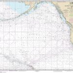
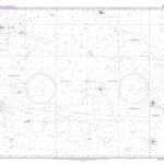
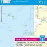 ATL3 Atlantic Islands: Azores, Madeira, Canary Islands, Cape Verde – 2018/19 Edition
 NOAA Chart 81092 – Commonwealth of the Northern Mariana Islands’”Pagan Island – Maug Islands
 NOAA Chart 530 – North America West Coast’”San Diego to Aleutian Islands and Hawai’ian Islands
 NGA Chart 29106 – Plans on the Ant. Penn. and Adj. Islands-Melchoir Islands
 NGA Chart 81345 – Mortlock Islands, East Caroline Islands
 Admiralty Chart 4445 – Jolo Islands to Basilan Islands
 NOAA Chart 530 – San Diego to Aleutian Islands and Hawai’ian Islands
 NZ14629 Samoa Islands to Northern Cook Islands and Tokelau
 Admiralty Chart PNG398 – Tulun Islands to Tanga Islands
 NGA Chart 81338 – Truk Islands [Caroline Islands]
 CHS Chart 6368 – Cabin Islands to Pilot Islands
 NZ14630 Samoa Islands to Southern Cook Islands
 Admiralty Chart 685 – Banana Islands to Turtle Islands