Disclosure : This site contains affiliate links to products. We may receive a commission for purchases made through these links.
Scotland Michelin Regional 501
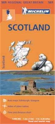
Scotland at 1:400,000 on an indexed touring map from Michelin – paper version – particularly good for indentifying scenic routes. The whole country is shown on one side of the map, with coverage extending south to include Newcastle and most of the Lake District. Enlargement show the Glasgow area (1:200,000) and main roads across Edinburgh (1:100,000).The map also shows locations with street plans in Michelin’s Red Guide to Hotels and Restaurants in Britain and in their Green Guide to Scotland. Topography of Scotland is very effectively indicated by relief shading with names of mountain ranges, valleys, peaks, etc, plus spot heights and colouring of forests and other wooded areas. Boundaries of national parks are marked. Special features provided in the presentation of road network include highlighting of scenic roads, more detailed gradient markings than found on most similar maps, height restrictions for bridges, load limits, and driving distances on main roads given in both miles and kilometres. Within Scotland, narrow roads with passing places are indicated. Railway lines and ferry routes are included.Places of interest indicated by symbols are less numerous or prominently marked than on other map series, but the maps do indicate locations with street plans in Michelin’s annual Red Guide to Hotels and Restaurants in Britain, as well as principal sights in their Green Guide to Scotland. The map has latitude and longitude lines at intervals of 20’. The index plus a distance/driving times table are next to the map.PLEASE NOTE: this title is also available from Stanfords in a waterproof and tear-resistant laminated version.To see the list of all the titles in this series please click on the series link.

Related Products:
 Scotland Michelin Regional 501 WATERPROOF
 Northern England – Midlands Michelin Regional 502
 Wales – South West England – Midlands Michelin Regional 503
 South East England – Midlands – East Anglia Michelin Regional 504
 Germany North West Michelin Regional 541
 Germany Southwest Michelin Regional 545
 Germany Northeast Michelin Regional 542
 Germany Mideast Michelin Regional 544
 Andalucia Michelin Regional 578
 Galicia Michelin Regional 571
 Aragon – Catalonia Michelin Regional 574
 Balearic Islands Michelin Regional 579
 Asturias – Cantabria Michelin Regional 572
 Portugal North Michelin Regional 591
 Castilla y Leon – Madrid Michelin Regional 575
 Comunidad Valenciana – Murcia Michelin Regional 577
 Portugal Central Michelin Regional 592
 Germany Southeast – Bavaria Michelin Regional 546
 Portugal South Michelin Regional 593
 Basque Country – Navarra – La Rioja Michelin Regional 573
 Extremadura – Castilla-la Mancha – Madrid Michelin Regional 576
 Germany: Michelin Regional Road Maps
 Germany Mid West Michelin Regional 543
 Spain: Michelin Regional Road Maps
 Portugal: Michelin Regional Road Maps
 Great Britain: Michelin Regional Tourist Maps
 Italy Central Michelin Regional 563
 Italy North West Michelin Regional 561
 Italy North East Michelin Regional 562
 Great Britain: Michelin 400K Road Maps
 Italy South Michelin Regional 564
 Poland: Michelin Regional Road Maps
 Belgium North & Centre Michelin Regional 533
 Poland South West Michelin Regional 557
 Benelux: Michelin Regional Road Maps and Atlases
 New England – Hudson Valley Michelin Regional 581
 Belgium South Michelin Regional 534
 Netherlands North Michelin Regional 531
 Southeastern USA Michelin Regional 584
 Benelux Michelin