Disclosure : This site contains affiliate links to products. We may receive a commission for purchases made through these links.
Scotland A-Z Regional Road Atlas

This A-Z map of Scotland is a full colour atlas featuring 92 pages of road mapping covering the whole of the country.Instantly recognizable and easy to use, A-Z road mapping includes the following features:Motorways with full junction detail, primary routes and destinations, A & B roads, under construction and proposed roads, service areas, tolls, mileages, national, county and unitary authority boundariesSelected safety camera locations with speed limitsSelected fuel stationsCairngorms and Loch Lomond & The Trossachs National Park boundariesHill shading sourced from Geo-Innovationsยฉ www.geoinnovations.co.ukSelected places of interest and tourist information centresThe mainland pages scale is 3.5 miles to 1 inch and the Western Isles, Shetland Islands and Orkney Islands scale is 4.5 miles to 1 inch.Also included are 20 city and town street maps for:- Aberdeen- Aviemore- Ayr- Dumfries- Dundee- Dunfermline- Edinburgh- Glasgow- Falkirk- Fort William- Hamilton- Inverness- Kilmarnock- Kirkcaldy- Motherwell- Oban- Paisley- Perth- St Andrews- StirlingThere is also a comprehensive index to cities, towns, villages, hamlets and locations.

Related Products:
 Scotland A-Z Road Atlas
 Northern England Regional A-Z Road Atlas
 Scotland Collins Handy Road Atlas
 Britain and Ireland Philip`s Road Atlas 2022 A4 PAPERBACK
 Britain & Ireland Philip`s Road Atlas 2022 A4 SPIRAL-BOUND
 Britain & Ireland Philip`s Motorist`s Road Atlas 2019 A3 PAPERBACK
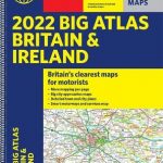 Britain & Ireland Philip`s Big Road Atlas 2022 A3 SPRIAL-BOUND
 Britain & Ireland Philip`s Big Road Atlas 2022 A3 PAPERBACK
 Britain & Ireland Philip`s Essential Road Atlas 2021 A4 PAPERBACK
 Britain & Ireland Philip`s Big Road Atlas 2021 A3 PAPERBACK
 Britain & Ireland Philip`s Complete Road Atlas 2020 SPIRAL-BOUND
 Britain & Ireland Philip`s Complete Road Atlas 2020 HARDBACK
 Britain and Northern Ireland Collins Big Road Atlas 2021 A3 PAPERBACK
 France Philip`s Navigator Road Atlas SPIRAL-BOUND
 Britain and Northern Ireland Collins Big Road Atlas 2022 A3 PAPERBACK
 Great Britain & Northern Ireland A-Z Road Atlas 2021 A3 PAPERBACK
Britain and Northern Ireland Collins Big Road Atlas 2023 A3 PAPERBACK
Great Britain & Northern Ireland A-Z Road Atlas 2023 A3 PAPERBACK
Great Britain & Northern Ireland A-Z Road Atlas 2021 A3 PAPERBACK
Britain and Northern Ireland Collins Big Road Atlas 2023 A3 PAPERBACK
Great Britain & Northern Ireland A-Z Road Atlas 2023 A3 PAPERBACK
 Great Britain & Northern Ireland A-Z Road Atlas 2022 A3 PAPERBACK
 Britain Philip`s Navigator Road Atlas FLEXI-BOUND
 Britain and Northern Ireland Collins Essential Road Atlas 2021
 Britain Philip`s Navigator Road Atlas SPIRAL-BOUND
Britain and Northern Ireland Collins Big Road Atlas 2023 A3 SPIRAL-BOUND
Britain Philip`s Navigator Road Atlas SPIRAL-BOUND
Britain and Northern Ireland Collins Big Road Atlas 2023 A3 SPIRAL-BOUND
 Britain and Northern Ireland Collins Big Road Atlas 2022 A3 SPIRAL-BOUND
Ireland Collins Comprehensive Road Atlas
Britain and Northern Ireland Collins Essential Road Atlas 2022 A4 SPIRAL-BOUND
Britain and Northern Ireland Collins Big Road Atlas 2022 A3 SPIRAL-BOUND
Ireland Collins Comprehensive Road Atlas
Britain and Northern Ireland Collins Essential Road Atlas 2022 A4 SPIRAL-BOUND
 Britain Philip`s Navigator Trucker`s Road Atlas A3 SPIRAL-BOUND
 Great Britain A-Z Road Atlas 2022 A4 SPIRAL-BOUND
 Scotland Philip`s Road Map
 Great Britain & Northern Ireland A-Z Super Scale Road Atlas 2022 A3 SPIRAL-BOUND
Great Britain & Northern Ireland A-Z Super Scale Road Atlas 2023 A3 SPIRAL-BOUND
Great Britain & Northern Ireland A-Z Super Scale Road Atlas 2022 A3 SPIRAL-BOUND
Great Britain & Northern Ireland A-Z Super Scale Road Atlas 2023 A3 SPIRAL-BOUND
 Britain Philip`s Driver`s Road Atlas A4 PAPERBACK
 Scotland Philip`s Navigator Road Atlas
 South East England A-Z Road Atlas
 Britain Philip`s Navigator Easy-Use Road Atlas
 Britain Philip`s Navigator Camping and Caravanning Road Atlas
 Wales A-Z Regional Road Atlas
 Southern England A-Z Regional Road Atlas
 Europe Philip`s Big Road Atlas 2021 A3
 Great Britain A-Z Handy Road Atlas 2021