Disclosure : This site contains affiliate links to products. We may receive a commission for purchases made through these links.
Schiehallion – Ben Lawers & Glen Lyon Harvey British Mountain Map XT40

Schiehallion, Ben Lawers and Glen Lyon area at 1:40,000, on a light, waterproof and tear-resistant map from Harvey, with on the reverse an extension to include Ben Chonzie, a geological map of the region, five crag diagrams with route lines/names/grades, plus advice on safely, maps reading etc. Coverage includes 27 Munros, 15 Corbets and 4 Grahams, all clearly identified by different colouring of their names.The map has contours at 15m intervals, altitude colouring and numerous stop heights. Additional colouring and graphics provide more detailed information on the topography and land use or vegetations: predominantly rocky ground, crags, boulder fields and scree, farmland, pastures, plantations, etc. Symbols indicate locations of campsites, caravan sites, youth hostels, bunkhouses, public telephones and toilets, car parks, information points, etc. Road network indicates residential roads, tarmac tracks, and forest roads or tracks. Footpaths show intermittent sections. For GPS users the map has British National Grid lines at intervals of 1km.On the reverse is a geological map of the area at 1:125,000 from the British Geological Survey; colouring to show bedrock geology is overlaid on a satellite image enhanced to provide a more vivid picture of the area’s topography. The map is accompanied by a geological time line and extensive notes. Additional information includes drawings of six crag areas: Creag na h-lolare with additional enlargement for the Low Wall, Balnacoul Castle with an enlargement for the South Buttress and Great Buttress, plus Lendock Boulders of Creag nan Eun. The map also provides extensive information on first aid and emergency procedures, advice on map reading and using a compass, useful contact details inclouding accommodation, etc.

Related Products:
 Ben Nevis & Glen Coe Harvey British Mountain Map XT40
 Knoydart – Kintail & Glen Affric Harvey British Mountain Map XT40
 White Peak Harvey British Mountain Map XT40
 Dark Peak Harvey British Mountain Map XT40
 Southern Highlands Harvey British Mountain Map XT40
 Dartmoor Harvey British Mountain Map XT40
 Snowdonia South Harvey British Mountain Map XT40
 Brecon Beacons Harvey British Mountain Map XT40
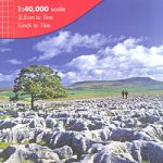 Yorkshire Dales Harvey British Mountain Map XT40
 Cairngorms & Lochnagar Harvey British Mountain Map XT40
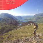 Lake District Harvey British Mountain Map XT40
 Snowdonia North / Gogledd Eryri Harvey British Mountain Map XT40
 North York Moors Harvey British Mountain Map XT40
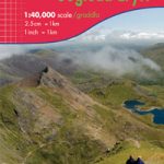
 Ben Lawers & Schiehallion Harvey Ultramap XT40
 Great Britain: Harvey British Mountain Maps
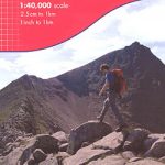
 Ben Lawers and Schiehallion Harvey Superwalker XT25
 Ben Lawers & Glen Lyon – Loch Tay, Killin & Kenmore OS Explorer Active Map OL48 (waterproof)
 Great Glen Way Harvey National Trail XT40
Torridon & Fisherfield Harvey British Mountain Map XT40
Great Glen Way Harvey National Trail XT40
Torridon & Fisherfield Harvey British Mountain Map XT40
 Glen Coe – Glen Etive & Black Mount Harvey Ultramap XT40
 Assynt & Coigach Harvey British Mountain Map XT40
 Glyndwr`s Way Harvey National Trail XT40
Ben Alder Harvey Ultramap XT40
Glyndwr`s Way Harvey National Trail XT40
Ben Alder Harvey Ultramap XT40
 St Cuthbert`s Way Harvey National Trail XT40
West Highland Way Harvey National Trail XT40
Cotswold Way Harvey National Trail XT40
St Cuthbert`s Way Harvey National Trail XT40
West Highland Way Harvey National Trail XT40
Cotswold Way Harvey National Trail XT40
 Dales Way Harvey National Trail XT40
 Cumbria Way Harvey National Trail XT40
 South Downs Way Harvey National Trail XT40
Ridgeway Harvey National Trail XT40
South Downs Way Harvey National Trail XT40
Ridgeway Harvey National Trail XT40
 Ben Lawyers & Glen Lyon – Loch Tay, Killin & Kenmore OS Explorer Map OL48 (paper)
 Rob Roy Way Harvey National Trail XT40
 Glen Affric Harvey Ultramap XT40
 Two Moors Way Harvey National Trail XT40
Speyside Way Harvey National Trail XT40
Two Moors Way Harvey National Trail XT40
Speyside Way Harvey National Trail XT40
 Shropshire Way Harvey National Trail XT40
Cleveland Way Harvey National Trail XT40
Shropshire Way Harvey National Trail XT40
Cleveland Way Harvey National Trail XT40
 Affric Kintail Way Harvey National Trail XT40
 Pembrokeshire Coast Path Harvey National Trail XT40
 Hadrian`s Wall Path Harvey National Trail XT40