Disclosure : This site contains affiliate links to products. We may receive a commission for purchases made through these links.
Scandinavia Norstedts Wall Map
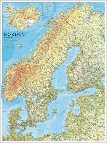
Clear and colourful 79x99cm wallmap of Norway, Sweden, Denmark, Finland and the Baltic States. Iceland & the Faeroes are shown in an inset. Towns, main roads and railways are marked, along with elevation colouring and provincial boundaries. Legend in English.The publishers, Norstedts Kartfรถrlaget, is the now privatized section of Sweden’s national survey organization, Lantmรคteriet.

Related Products:
 Sweden: Norstedts Regional Road Maps
 Gotland Norstedts Road Map
 Gothenburg Tourist Map
 Central Norrland Norstedts Regional Map 5
Western Svealand Norstedts Regional Map 2
Northern Svealand – Southern Norrland Norstedts Regional Map 4
Central Norrland Norstedts Regional Map 5
Western Svealand Norstedts Regional Map 2
Northern Svealand – Southern Norrland Norstedts Regional Map 4
 Southern Gรถtaland Norstedts Regional Map 1
 Eastern Svealand Norstedts Regional Map 3
 Northern Norrland Norstedts Regional Map 6
 Sweden Norstedts Wall Map
 Sweden: Norstedts 90K Cycling Maps
 Cap of the North / Nordkalotten Norstedts Road Map
 World Norstedts Black & White Political Wall Map
 Sweden Wall Map
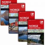 Norway: Norstedts Regional Road Maps
 Sweden: Lantmรคteriet 250K Topographic Survey
Sweden Norstedts Road Atlas 2021
Sweden: Lantmรคteriet 250K Topographic Survey
Sweden Norstedts Road Atlas 2021
 Sweden Norstedts Large Road Atlas
 Sweden Norstedts EasyMap
Sweden Norstedts Road Map
Sweden Norstedts Road Atlas
Sweden Norstedts EasyMap
Sweden Norstedts Road Map
Sweden Norstedts Road Atlas
 Finland – Northern Scandinavia Reise Know-How
 Sweden: Norstedts 1:50,000 – 1:75,000 Topographic maps
 Sweden: Norstedts Topo50
Jรคmtlandsfjรคllen Norstedts Outdoor 11
Sweden: Norstedts Topo50
Jรคmtlandsfjรคllen Norstedts Outdoor 11
 Jรคkkvik – Ammarnรคs Norstedts Outdoor 5
Kvikkjokk – Jรคkkvik Norstedts Outdoor 4
Skรคckerfjรคllen – Storlien – ร…re Norstedts Outdoor 10
Ramundberget – Funรคsdalen – Vemdalen Norstedts Outdoor 12
Rogen – Grรถvelsjรถn – Idre Norstedts Outdoor 13
Jรคkkvik – Ammarnรคs Norstedts Outdoor 5
Kvikkjokk – Jรคkkvik Norstedts Outdoor 4
Skรคckerfjรคllen – Storlien – ร…re Norstedts Outdoor 10
Ramundberget – Funรคsdalen – Vemdalen Norstedts Outdoor 12
Rogen – Grรถvelsjรถn – Idre Norstedts Outdoor 13
 Abisko – Kebnekaise – Nikkaluokta Norstedts Outdoor 1
Nikkaluokta – Sarek – Saltoluokta Norstedts Outdoor 2
Saltoluokta – Padjelanta – Kvikkjokk Norstedts Outdoor 3
Bรถrgefjell – Kittelfjรคll – Fatmomakke Norstedts Outdoor 7
Saxnรคs – Borgafjรคll – Gรคddede Norstedts Outdoor 8
Gรคddede – Hotagsfjรคllen – Fรถllinge Norstedts Outdoor 9
Fulufjรคllet – Trysil – Sรคlen Norstedts Outdoor 14
Ammarnรคs – Hemavan- Lill-Bjรถrkvattnet Norstedts Outdoor 6
Abisko – Kebnekaise – Nikkaluokta Norstedts Outdoor 1
Nikkaluokta – Sarek – Saltoluokta Norstedts Outdoor 2
Saltoluokta – Padjelanta – Kvikkjokk Norstedts Outdoor 3
Bรถrgefjell – Kittelfjรคll – Fatmomakke Norstedts Outdoor 7
Saxnรคs – Borgafjรคll – Gรคddede Norstedts Outdoor 8
Gรคddede – Hotagsfjรคllen – Fรถllinge Norstedts Outdoor 9
Fulufjรคllet – Trysil – Sรคlen Norstedts Outdoor 14
Ammarnรคs – Hemavan- Lill-Bjรถrkvattnet Norstedts Outdoor 6
 Canada ITMB
 Stockholms Skargard Norstedts Outdoor 27