Disclosure : This site contains affiliate links to products. We may receive a commission for purchases made through these links.
Sasso San Gottardo Once and Today Swisstopo Map No. 305
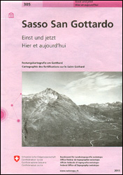
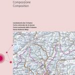
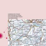
The area around the Sasso San Gottardo fortifications, build to protect access to the Gotthard Pass, presented in the Swisstopo’s ‘Once and Today” series on extracts from topographic survey mapping from mid-1800s to the present day and on aerial photos.Map extracts range from the 1851 survey, the oldest topographic mapping of the Gotthard region, to a special 1:10,000 map declassified only in 2009 and the present day 1:25,000 topographic survey mapping with the underground fortifications overprinted on it. The title also includes panels showing coverage of the area by artillery ranges and examples of how stereoscopic photographs helped in surveying the region more accurately. Map legend and the accompanying text include English.For the list of other titles in this series please click on the series link.

Related Products:
 Gotthard Railway Axis Once & Today Swisstopo Map No. 307
 Walking in Abruzzo: Gran Sasso, Maiella and Abruzzo National Parks, and Sirente-Velino Regional Park
 Gran Sasso and Monti della Laga National Park Kompass 2476
 Monte Carpegna – Sasso di Simone
 Thuner See – Central Switzerland Swisstopo 101
 Gotthard Swisstopo 5001
 Glarnerland – Bundnerland Swisstopo 106
 Andermatt – Urseren – Gotthard – Oberalp – Lago Ritom Swisstopo Hiking 3314T
 Ticino Swisstopo 107
 Woolwich 1914
 Glarnerland, Bรผndnerland Swisstopo 106
 Valais / Wallis Swisstopo 105
 Switzerland: Swisstopo “Once and Today” Historical Maps
 Basel Swisstopo 26
 Vorarlberg Swisstopo 34
 Brรผnigpass Swisstopo 37
 Flรผelapass Swisstopo 39
 Le Leman Swisstopo 40
 Oberwallis Swisstopo 42
 Val de Bagnes Swisstopo 46
 Besanรงon Swisstopo 30
 Beromรผnster Swisstopo 32
 Bรถzberg Swisstopo 27
 Toggenburg Swisstopo 33
Vallorbe Swisstopo 35
Toggenburg Swisstopo 33
Vallorbe Swisstopo 35
 Panixerpass Swisstopo 38
Col du Pillon Swisstopo 41
Saane / Sarine Swisstopo 36
Panixerpass Swisstopo 38
Col du Pillon Swisstopo 41
Saane / Sarine Swisstopo 36
 Lindau Swisstopo 28bis
Sopra Ceneri Swisstopo 43
Lindau Swisstopo 28bis
Sopra Ceneri Swisstopo 43
 Haute-Savoie Swisstopo 45
 Sotto Ceneri Swisstopo 48
 Basel – Lucerne Swisstopo 102
Zurich – St. Gallen Swisstopo 103
Basel – Lucerne Swisstopo 102
Zurich – St. Gallen Swisstopo 103
 Lausanne – Bern Swisstopo 104
 Biel / Bienne Swisstopo 31
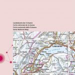
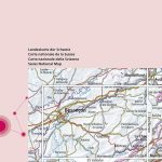
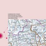
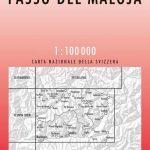 Passo del Maloja Swisstopo 44
 Monte Rosa Swisstopo 47
 Sardona Tectonic Arena – UNESCO World Heritage Site Swisstopo Hiking 5080T
 Berne Once and Today Swisstopo Map No. 301