Disclosure : This site contains affiliate links to products. We may receive a commission for purchases made through these links.
Sarawak – Sabah – Brunei ITMB
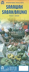
Sarawak and Sabah, the Malaysian part of Borneo, and Brunei, at 1:620,000 on an indexed, double-sided map from ITMB with street plans of Kota Kinabalu, Kuching and Bandar Seri Bengawan, plus an enlargement for the Mount Kinabalu trail.The map is double-sided, with a generous overlap between the sides. Topography is shown by altitude colouring and spot heights, both in feet. Swamps areas are also indicated. The map shows the region’s road network indicating driving distances on selected main routes. Local airports and ferry routes are marked. Also shown are internal administrative visions into provinces. Symbols indicate various places of interest including selected tourist accommodation, beaches and watersport sites, etc. Latitude and longitude lines are drawn at 1ยฐ intervals. Each side of the map has a separate index. Also provided are street plans of central Kota Kinabalu, Kuching and Bandar Seri Bengawan, all annotated with tourist accommodation, various facilities and places of interest. An enlargement at 1:50,000 approximately shows the trail to the summit to Mount Kinabalu with contours at 500 feet but spot heights in both feet and metres.

Related Products:
 Malaysia ITMB
 Borneo / Kalimantan ITMB
 Malaysia – Brunei Nelles
 Borneo – Malaysia East – Brunei – Kalimantan Nelles
 Borneo: Sabah – Sarawak – Brunei Footprint Handbook
 Namibia ITMB
 Myanmar / Burma ITMB
 Guyana, Suriname & French Guiana ITMB
 Cayman Islands & Jamaica ITMB
 Cusco & Peru South ITMB
 Ghana ITMB
 Malaysia Periplus Travel Map
 Nigeria & Niger ITMB
 Kilimanjaro & Tanzania North ITMB
 Hue – Da Nang & Vietnam Centra ITMB
 Togo & Benin ITMB
 South Africa – Lesotho – Swaziland ITMB
 Tanzania ITMB
 Virgin Islands (US and British) ITMB
 Mali ITMB
 Oman & Yemen ITMB
 Middle East ITMB Travel Atlas
 Ethiopia & Eritrea ITMB
 Guangzhou & China South ITMB
 Dominica & Saint Lucia ITMB
 Romania & Moldova ITMB
 Thailand, Vietnam, Laos & Cambodia ITMB Travel Atlas
 Morocco ITMB
 Cuba West ITMB
 Cameroon & Gabon ITMB
 Cuba ITMB
Zambia & Eastern Africa ITMB Road Map
Cuba ITMB
Zambia & Eastern Africa ITMB Road Map
 Antigua & Dominica ITMB
 Chile ITMB
 Taiwan & Taipei ITMB
 Bolivia ITMB
 Marrakesh & Northern Morocco ITMB
 Bahamas ITMB
 Peru ITMB