Disclosure : This site contains affiliate links to products. We may receive a commission for purchases made through these links.
Categories
-
Best Sellers
-

The Hebridean Way: Long-Distance Walking Route Through Scotland`s Outer Hebrides
Officially launched in 2017, the Hebridean Way offers walkers the opportunity to experience the magic of Scotland`s Outer Hebrides in one inspirational journey. The waymarked route Read More » -

Hug This Book!
An energetic, heartfelt, and humorous ode to book love – now in a board book format!You can spin and twirl and dance with this book.You can Read More » -

Guadalajara
Topographic mapping from Mexico’s national survey agency, Instituto Nacional de Estadรญstica, Geografรญa e Informรกtica. The maps have contours at 20m intervals with relief shading and indicate Read More » -

Romsey, Andover & Test Valley – Stockbridge & Ludgershall OS Explorer Active Map 131 (waterproof)
Romsey, Andover, Test Valley, Stockbridge and Ludgershall area on a detailed topographic and GPS compatible map No. 131, waterproof version, from the Ordnance Survey’s 1:25,000 Explorer Read More » -
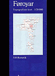
Saksunardalur
Topographic survey of Faroe Islands at 1:20,000 prepared by the Danish national mapping agency Kort og Matrikelstyrelsen. The islands’ topography is vividly presented by contours at Read More » -

Kittila
The 1:50,000 topographic map gives a more general picture of the ground features than a basic map. It shows settlements, houses, roads, cultivated areas, waterways, cutting Read More » -

Basic Documents: Volume I, 2010 Edition
This edition incorporates amendments to the Convention on the International Maritime Organization up to December 2009.It also includes amendments to the Rules of Procedure of:- the Read More » -

Walking Brooklyn: 30 walking tours exploring historical legacies, neighborhood culture, side streets, and waterways
The new second edition of the popular book Walking Brooklyn: 30 Tours Exploring Historical Legacies, Neighborhood Culture, Side Streets, and Waterways provides a unique guide to Read More » -

Lancaster, Morecambe & Fleetwood OS Explorer Map 296 (paper)
Lancaster, Morecambe and Fleetwood area on a detailed topographic and GPS compatible map No. 296, paper version, from the Ordnance Survey’s 1:25,000 Explorer series. MOBILE DOWNLOADS: Read More » -

USA West Marco Polo Map
USA West, the Rockies and the western states, at 1:2,000,000 from Marco Polo Travel Publishing, with prominent highlighting of interesting locations, plus a 71-page index booklet Read More »
-


