Disclosure : This site contains affiliate links to products. We may receive a commission for purchases made through these links.
Santorini – Thirasia Anavasi 10.24

Santorini with the nearby Thirasia at 1:26,000 on light, waterproof and tear-resistant, contoured and GPS compatible map from Anavasi, with on the reverse special maps of the two islands highlighting numerous hiking paths.On one side the two islands, with Nea Kameni, Palea Kameni and Aspronisi, are presented with contours at 20 metre intervals with additional altitude colouring. Road network indicates dirt roads in poor condition, gives distances on most small local roads, and shows locations of petrol stations. Symbols highlight various places of interest, including beaches and scuba diving sites, campsites, archaeological remains, etc. Place names are in both Greek and Latin alphabet. The map has a 1-km UTM grid plus latitude and longitude crosshairs at 1’ intervals.On the reverse are slightly simplified maps of the two islands highlighting numerous hiking options, 19 on Santorini and 6 on Thirasia, each accompanied by a brief description. Map legend and all the text include English.To see which other Greek islands are covered by maps from Anavasi, please click on the series link.

Related Products:
 Tinos Anavasi 10.20
 Spetses Anavasi 10.30
 Rhodes & Symi Anavasi 10.38
 Cephalonia / Kefalonia – Ithaca Anavasi 9.3
 Santorini Reise Know-How
 Skyros Anavasi 10.14
 Hydra Anavasi 10.40
 Alonisos – Northern Sporades Marine Park Anavasi 9.2
 Kalymnos – Telendos & Pserimos Anavasi 10.32
 Greece: Anavasi Maps of Greek Islands
 Santorini Terrain Editions 313
 Naxos & Small Cyclades Anavasi 10.28
 Sikinos Anavasi 10.29
 Chalki Anavasi 10.33
 Chios – Psara – Inouses Anavasi 10.31
 Kea / Tzia Anavasi 10.41
 Northern Agrafa – Plastira Lake Anavasi 4.1
 Milos – Kimolos – Polyvos Anavasi 10.45
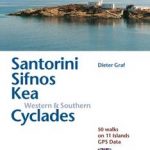 Santorini, Sifnos, Kea, Western & Southern Cyclades: 50 Walks on 11 Islands
 Skiathos Anavasi 10.11
 Corfu – Othoni – Erikouse – Mathraki Anavasi 9.4
 Sifnos Anavasi 10.26
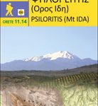 Psiloritis – Mt Ida Anavasi 11.14
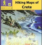 Greece: Anavasi Hiking Maps of Crete
 Mykonos – Delos – Rheneia / Rineia Anavasi 10.42
 Taygetos – North Taygetos Anavasi 8.1
 Cyclades – Argosaronic Anavasi Regional Map R1
 Serifos Anavasi 10.25
 Valia Kalda – Vasilitsa Anavasi 6.4
 Anafi Anavasi 10.47
 Paxos – Antipaxos Anavasi 9.2
 Mt Olympus Anavasi 6.11
 Paros – Antiparos Anavasi 10.23
 Mainalo – Artemisio – Lyrkeio – Farmakas – Ktenias Anavasi 8.5
 Karpathos – Saria Anavasi 10.50
 Lefkada Anavasi 9.1
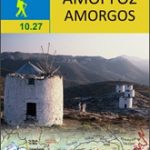 Amorgos Anavasi 10.27
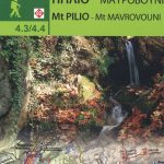 Mount Pelion – Mount Mavrovouni Anavasi 4.3/4.4
 Andros Anavasi 10.21