Disclosure : This site contains affiliate links to products. We may receive a commission for purchases made through these links.
Santiago AB Kartenverlag Hiking Map
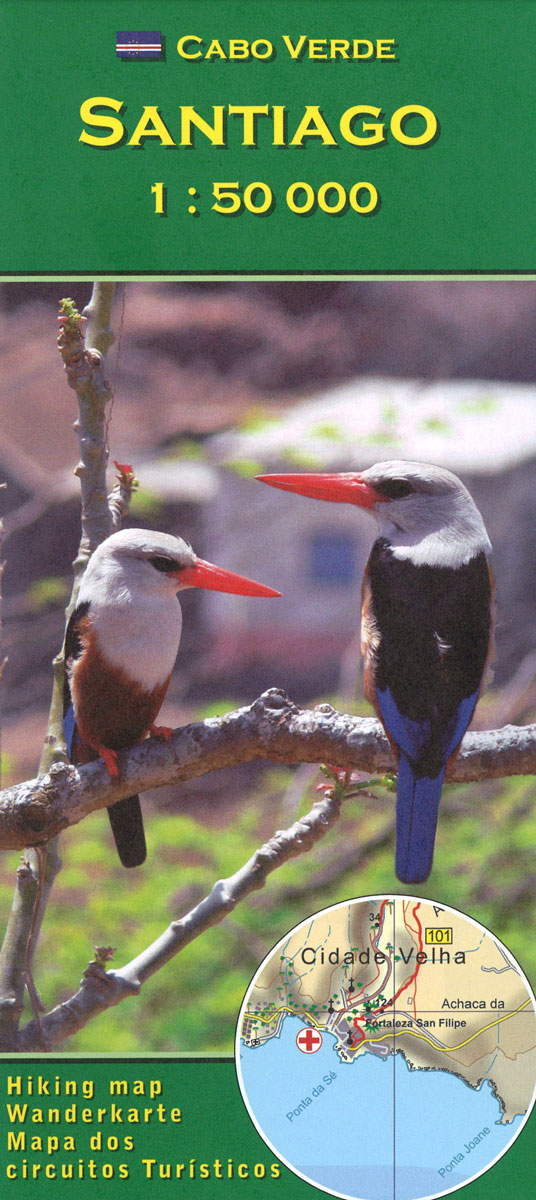
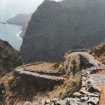
Santiago Island in the Cape Verde archipelago on a detailed, GPS compatible map at 1:50,000 from AB Kartenverlag, highlighting 33 hiking and mountain bike routes and including small plans of Praia, Tarrafal and Cidade Velha. The map is double-sided with a very generous overlap between the sides. Contours with relief shading and spot heights present the topography. The map shows the network of local roads, tracks and footpaths. Symbols indicate locations of viewpoints, diving sites and medical facilities.33 selected walks, from one to five hours long, are highlighted on the map and listed in a table with details of the terrain, altitude, degree of difficulty and suitability as mountain bike routes. Latitude and longitude grid is at intervals of 1’. Map legend and all the accompanying text include English.Also included are small plans of Praia, Tarrafal and Cidade Velha, indicating main facilities.

Related Products:
 Sรฃo Nicolau AB Kartenverlag Hiking Map
 Fogo – Brava AB Kartenverlag Hiking Map
 Santo Antรฃo AB Kartenverlag Hiking Map
 Sรฃo Vicente – Mindelo AB Kartenverlag Hiking Map
 Cape Verde AB Kartenverlag Road and Leisure Map
 Boa Vista AB Kartenverlag Hiking Map
 Italy: Kompass 50K Hiking Maps
 Evighedsfjorden Hiking Map
 Qegertarsuaq Hiking Map
 The Hermitage (Ruta de l`Ermitร ) Hiking Circuit
 Santiago de Compostela – Roncevaux / Roncesvalles to Santiago IGN 89022
 Camino de Santiago Rother Guide
 Austria/Germany/Slovenia: Kompass Hiking Maps
 Gstaad – Lenk – Adelboden Swisstopo Hiking 3304T
 AB Kartenverlag Hiking Maps
 Switzerland: Hallwag 50K Hiking Atlases
 Easter Island & Santiago ITMB
 Camino de Santiago: Stages 31/32, Arzรบa/Santiago de Compostela 50K CNIG Map
 Karavanke Mountains – Kep to Kosuta Kartografija WATERPROOF Hiking Map
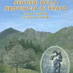 Prato Province Hiking Routes
 Kythnos Hiking Guide
 Austria: Freytag & Berndt Hiking Maps
 Hauenstein – Belchenflue Swisstopo Hiking 3325T
Lugano – Mendrisiotto Swisstopo Hiking 3328T
Hauenstein – Belchenflue Swisstopo Hiking 3325T
Lugano – Mendrisiotto Swisstopo Hiking 3328T
 Austria Freytag & Berndt Hiking Atlas
 Lotschental – Aletschgebiet 33K Swisstopo Hiking 3324T
 South Tyrol Kompass Hiking & Recreational Kompass Ring-binder Atlas No. 2703: Bormio – Merano – Bolzano – Cortina d`Ampezzo
NP Kellerwald-Edersee – Habichtswald NP – Medebach Hiking Region Kompass 845
South Tyrol Kompass Hiking & Recreational Kompass Ring-binder Atlas No. 2703: Bormio – Merano – Bolzano – Cortina d`Ampezzo
NP Kellerwald-Edersee – Habichtswald NP – Medebach Hiking Region Kompass 845
 Greece: Terrain Editions Maps for Hiking and Recreational Pursuits
 Mountains around Vienna Freytag & Berndt Hiking Atlas
Greenland : Greenland Tourism Hiking Maps
Mountains around Vienna Freytag & Berndt Hiking Atlas
Greenland : Greenland Tourism Hiking Maps
 Arosa – Davos Swisstopo Hiking 3309T
 Kamnik and Savinja Alps Kartografija WATERPROOF Hiking Map
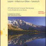 Les Diablerets – Leysin – Villars-sur-Ollon – Sanetsch Swisstopo Hiking 3317T
 Unterengadin / Lower Engadine – Zernez – Scoul – Sent Swisstopo Hiking 3327T
 Albania: Huber Verlag 50K Hiking and Cycling Maps
 Sรคntis – Toggenburg – Churfristen – Alpstein Swisstopo Hiking 3301T
 Schaffhausen – Klettgau – Randen – Stein am Rhein Swisstopo Hiking 3329T
 Safiental – Lenzerheide Swisstopo Hiking 3310T