Disclosure : This site contains affiliate links to products. We may receive a commission for purchases made through these links.
Santa Maria Navarrese to Quirra
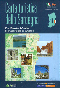
Santa Maria Navarrese to Quirra area in a series of contoured, GPS compatible maps at 1:60,000 from Ed. Abies, with extensive tourist information including special recreational routes plus additional coverage at more detailed scales of selected popular areas.*Main series at 1:60,000 (Nos. 1 to 12)*The maps have contours at 100m intervals and colouring for woodlands and maquis shrubland. Local trails are highlighted, with additional overprint for selected hiking, mountain bike and kayaking routes listed on the reverse of the maps with brief notes and grading for the degree of difficulty. All the maps have a UTM grid for GPS users.Very extensive range of symbols highlight numerous places of interest and tourist facilities, including campsites and caravan parks, beaches, sport and recreational sites, archaeological remains and nuraghi, etc. The maps also indicate places where typical local products can be purchased. On the reverse each title has descriptions of its main places of interest, beaches, etc.*More detailed maps at 1:25,000/1:30,000 (Nos. 3A to 12A)*Contour interval is 25m, plus colouring for vegetation. Local trails are marked but unless indicated in the individual description, special routes are not included. Tourist overprint is also less extensive than on the 1:60,000 maps. Most titles have GPS coordinates. On the reverse are extensive notes describing the area. For more details see individual descriptions. *Map legend and additional text on all the maps includes English.*

Related Products:
 Santa Margherita to Calasetta
Santa Caterina di Pittinuri to Capo Caccia
Santa Margherita to Calasetta
Santa Caterina di Pittinuri to Capo Caccia
 Gulf of Orosei
Gulf of Oristano
Bay of Porto Conte to Platamona
Capo San Lorenzo to Capitana
Gulf of Orosei
Gulf of Oristano
Bay of Porto Conte to Platamona
Capo San Lorenzo to Capitana
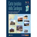 Porto Rotondo to Capo Comino
Cagliari and Golfo degli Angeli
Marina di Sorso to Costa Paradiso
Italy: Ed. Abies Recreational Maps of the Sardinian Coast
Costa Smeralda: Portobello Di Gallura To Golfo Aranci
Posada
Siniscola
Isola di San Pietro
Loiri – Porto San Paolo
Porto Rotondo to Capo Comino
Cagliari and Golfo degli Angeli
Marina di Sorso to Costa Paradiso
Italy: Ed. Abies Recreational Maps of the Sardinian Coast
Costa Smeralda: Portobello Di Gallura To Golfo Aranci
Posada
Siniscola
Isola di San Pietro
Loiri – Porto San Paolo
 Urzulei
Villasimius – Torre delle Stelle – Costa Rei
Urzulei
Villasimius – Torre delle Stelle – Costa Rei
 Serbia/Montenegro: Geokarta Hiking and Recreational Maps
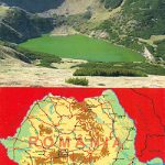
 Retezat Mountains Bel Alpin Tourist Map
 Cindrel Mountains
 Santa Barbara – Carpinteria – Santa Maria CA
Santa Maria del Campo CNIG Topo 275
Santa Barbara – Carpinteria – Santa Maria CA
Santa Maria del Campo CNIG Topo 275
 Nepal: Nepa Trekking and Hiking Maps
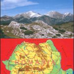 Retezat Mountains
 Santa Fe – Truchas Peak NM
 Anafi Anavasi 10.47
 Anafi Terrain Editions 318
 Santa Maria del Cami CNIG Topo 698-2
 El Puerto de Santa Maria CNIG Topo 1061-2
 Syros Terrain Editions 305
 Sifnos Terrain Editions 304
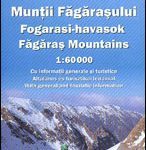 Fagaras Mountains Dimap Hiking Map
 Skyros Terrain Editions 322
 Serifos Terrain Editions 303
 Tinos Terrain Editions 308
 Alonissos Terrain Editions 321
 Santa Monica Mountains CA
 Naxos Terrain Editions 311
 Ios Terrain Editions 315
 Aeolian (Lipari) Islands Kompass 693