Disclosure : This site contains affiliate links to products. We may receive a commission for purchases made through these links.
San Gimignano – Volterra
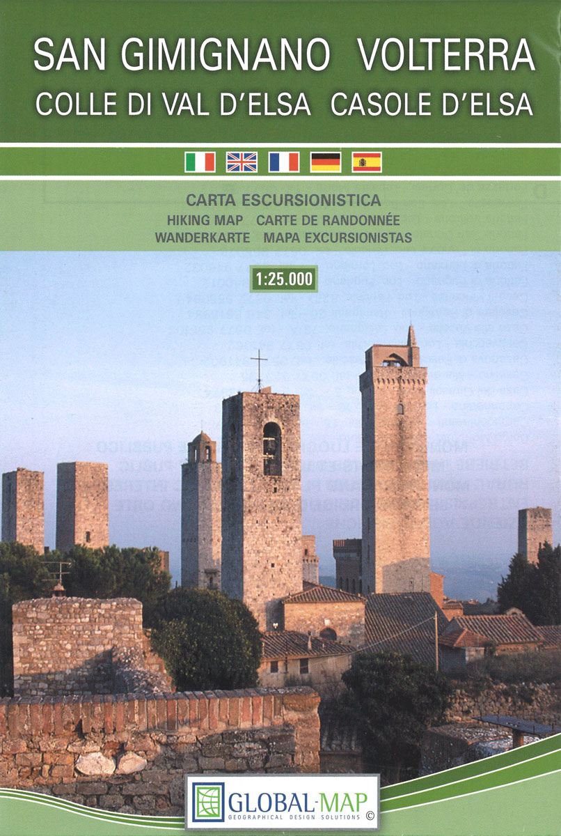
Contoured, GPS compatible map of one of Tuscany’s most visited areas, with hiking and mountain bike routes, plus on the reverse street plans of San Gimignano and Volterra, recommendations for rural accommodation, etc.The main map covers the area at 1:25,000 and has contours at 25m intervals. An overprint highlights numerous waymarked hiking trails, cross-referenced to a list of recommended routes. The map indicates picturesque towns and villages and highlights various places of interest and facilities, including campsites. UTM grid is at 1km intervals.On the reverse are two large street plans of San Gimignano (1:3,000) and Volterra (1:4,500), both annotated with main sights and indexed. Unusually for street plans, both are contoured to show the topography of these interesting towns. Also included are historical notes plus lists of recommended accommodation. Map legend and all the notes include English.

Related Products:
 San Gimignano and Volterra
 San Gimignano – Colle Val d`Elsa – Poggibonsi Edizioni Multigraphic 511
 Volterra and its Environs Edizioni Multigraphic 513
 Siena – Volterra – Massa Marittima – Roccastrada Kompass 2462
 Tarcau Mountains and Ghimes Dimap Hiking Map
Rarau-Giumalau Mountains and Bucovina Monasteries Dimap Hiking Map
Tarcau Mountains and Ghimes Dimap Hiking Map
Rarau-Giumalau Mountains and Bucovina Monasteries Dimap Hiking Map
 Retezat Mountains Dimap Hiking Map
St Anna Lake Dimap Hiking Map
Retezat Mountains Dimap Hiking Map
St Anna Lake Dimap Hiking Map
 Danube Bend Cartographia Tourist Map 31
 Korรงa and Environs
 Puka and Environs
 Elbasan – Berat
 Saranda and Environs
 Parang Mountains Dimap Hiking Map
 Shkodra and Environs
 Albania: Huber Verlag 50K Hiking and Cycling Maps
 Vlora and Environs
 Bihor Mountains Dimap Hiking Map
 Tirana – Durrรซs – Kruja
 Tropoja – B. Curri – Valbona
 Lake Balaton Cartographia Leisure Map
 Bulgaria (with Mountain Resorts)
 Borzsony Cartographia Tourist Map 5
 Bรผkk Cartographia Tourist Map 29
 Vรฉrtes Cartographia Tourist Map 20
 The Hills of Siena & Bosco di Lecceto 25K Ed. Multigraphic Map No. 509
Gurghiu Mountains Northern and Central Dimap Hiking Map
The Hills of Siena & Bosco di Lecceto 25K Ed. Multigraphic Map No. 509
Gurghiu Mountains Northern and Central Dimap Hiking Map
 Lake Balaton Cycling Atlas
 Lake Balaton II West Cartographia Water Sports & Cycling Map
 Bulgaria (with Street Plans of Black Sea Resorts)
 Mรกtra Cartographia Tourist Map 14
 Szigetkoz – Tokoz – Czilizkoz
 Zselic Cartographia Tourist Map 17
 Gerecse Cartographia Tourist Map 10
Vermoshi – Tamare – Razma – Thethi
Gerecse Cartographia Tourist Map 10
Vermoshi – Tamare – Razma – Thethi
 Fagaras Mountains Dimap Hiking Map
 Koszeg Hills Cartographia Tourist Map 13
 Samokov – Borovets with the Rila Mountains
 Cserhat – Karancs – Medves Cartographia Tourist Map 8
Gemenc – Szekszard-Hills Tourist Map
Cserhat – Karancs – Medves Cartographia Tourist Map 8
Gemenc – Szekszard-Hills Tourist Map