Disclosure : This site contains affiliate links to products. We may receive a commission for purchases made through these links.
San Francisco & Northern California ITMB
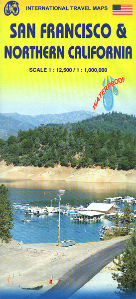
San Francisco on a waterproof and tear-resistant, very clear and well presented street plan, extending further south than most tourist maps of the city, with on the reverse a road map of northern California with altitude colouring emphasizing its topography.On one side is a street plan of San Francisco at 1: 12,500, extending from the Bay to the Pacific and further south than most tourist street plans, beyond Haight-Ashbury and Castro to, on the Pacific side, the Zoo and Lakeside, and on the Bay side to the UCSF Campus in Mission Bay. Names of districts are clearly shown, with main traffic arteries highlighted and one way streets marked. Lines and stops of the transit system, including the cable car and the vintage tram lines, are also very well presented. The colouring indicates the city’s numerous parks and green spaces. The map highlights locations of various places of interest and numerous hotels. Street index is next to the plan. Also included is a diagram of the Bay Area Rapid Transit System, plus a small road map of the region showing access to the international airport, the A1 Pacific Highway, Oakland, Berkeley, etc.On the reverse is a road map of northern California at 1:1,000,000 extending south to Santa Barbara and north to Crater Lake National Park in Oregon. Altitude colouring with elevation in feet presents the topography. The map shows the region’s road and rail networks, and highlights national parks and other protected areas, campsites and various places of interest. Latitude and longitude lines are drawn at 1ยฐ intervals. The index is next to the map.To see other regional titles from ITMB covering USA please click on the series link.

Related Products:
 Los Angeles & Southern California ITMB
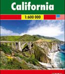
 California ITMB
 San Francisco – Northern Peninsula Cities CA Rand McNally
 Montreal & Southern Quebec ITMB
 San Diego & USA South West Border ITMB
 San Francisco CA Transit and Street Map Global Graphics
 Sao Paulo & Brazil South Coast ITMB
 Delhi & Northern India ITMB
 Jasper National Park & Northern Alberta ITMB
 Bangkok & Thailand South ITMB
 Vancouver & Greater Vancouver ITMB
 Hanoi – Vietnam North ITMB
 Argentina South & Tierra del Fuego ITMB
 Washington DC & Eastern Corridor (Boston to DC) ITMB
 San Francisco Red Maps
 Chicago & Lake Michigan ITMB
 Shanghai & China South East ITMB
 Tehran & Northern Iran ITMB
 Oslo / Bergen & South of Norway ITMB
 California F&B
 Accra & Ghana South ITMB
 Bangladesh & India East ITMB
 Manhattan & New York State ITMB
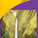 Oregon & Northern California Coast Road & Recreation Map
 Marrakesh & Northern Morocco ITMB
 Moon Road Trip USA: California – San Francisco, Yosemite, Las Vegas, Grand Canyon, Los Angeles & the Pacific Coast
 Santiago & Chile North ITMB
 South America ITMB
 Iran & Tehran ITMB
 Philadelphia & Mid-Atlantic States ITMB
 Sydney & Australia East ITMB
 Saudi Arabia & Kuwait ITMB
 Orlando & Central Florida ITMB
 Jordan & Syria ITMB
 Guangzhou & China South ITMB
 Miami & South Florida ITMB
 China South ITMB
 Auckland & North Island ITMB