Disclosure : This site contains affiliate links to products. We may receive a commission for purchases made through these links.
Samos & Northern Dodecanese Islands 50K Kompass Map No.253

Samos at 1:50,000 with Icaria, Thimena, Fourni, Patmos, Leipsoi and Arkoi at 1:100,000, from Kompass, with and tourist overprint highlighting walking trails, places of interest and various facilities plus plans of the islands’ main towns and sites. The map is printed on sturdy, waterproof and tear-resistant synthetic paper.Topography of the islands is shown by contours at 100m intervals, spot heights and subtle relief shading. Road network includes local roads and cart tracks, with driving distances given on main routes. The map also shows ferry connections. Symbols mark various places of interest including youth hostels and campsites, sport and recreational facilities, beaches, archeological sites, etc. All place names are in Greek and Latin alphabets. For hikers, an overprint highlights recommended trails, indicating steep and difficult sections. The map has a 2-km UTM grid. Map legend includes English.Also provided are street plans of Samos/Vathi, Karlovassi, Pythagorio and Kokkari highlighting tourist accommodation and various facilities and sights, plus plans of two sites: the temple of Hera at Heraion and the Monastery of Saint John the Theologian on Patmos. A small map shows the whole of the Aegen with ferry connection with the mainland and between the islands.

Related Products:
 Samos – Patmos – Ikaria – Kalymnos and Six Neighbouring Islands
 Samos F&B
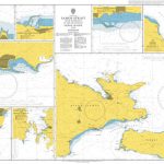 Admiralty Chart 1526 – Samos Strait with Harbours in the Islands of Samos ‘“ Ikaria and Fournoi
 Samos Terrain Editions 331
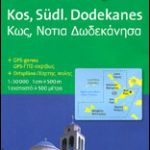 Kos – Southern Dodecanese Kompass 252
 Samos Terrain Editions 331 SUPERCEDED
 Northern Dodecanese: Kalymnos, Telendos, Leros, Patmos, Lipsi, Arki and Agathonisi
 Lofoten and Vesteralen Islands
 Malta – Gozo Kompass 235
 Samos with Ikaria and Fourni
 Faroe Islands
 Spain: Kompass Maps of the Canary Islands
 Spain: Kompass Maps of the Balearic Islands
 Walking on Samos
 Canary Islands ITMB
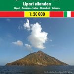
 Aeolian (Lipari) Islands Global Map Tourist Map
 Aeolian (Lipari) Islands Kompass 693
 Aeolian (Lipari) Islands and Southern Italy F&B
 Rhodes Kompass 248
 Polynesian Islands ITMB Travel Atlas
 Virgin Islands (US and British) ITMB
 Madeira Kompass 234
 Samos Hiking Guide
 Balearic Islands Michelin Regional 579
 Dalmatian Coast 1 – Zadar – Kornati Islands F&B
 Northland: Whangarei, Bay of Islands and 61 Provincial Towns Pathfinder
 Gulf Islands – Nanaimo and Islands ITMB
 Virgin Islands (US and British)
 Cape Verde Islands F&B
 Greece & the Islands Marco Polo Map
 Orkney – Shetland Islands Leisure and Tourist Map
 US Virgin Islands Adventure and Dive Map/Guide
 Cayman Islands & Jamaica ITMB
Samos: 2016
Cayman Islands & Jamaica ITMB
Samos: 2016
 San Juan Islands WA
 Mallorca 4-Map Set Kompass 2230
 Lofoten – Vesteralen Islands – Senja Cappelen Sectional Road Map
 Rhodes, Karpathos, Kos and the Southern Dodecanese – Walking the Greek Islands
 Azores 2-Map Set Kompass 2260
 Istria Kompass 238