Disclosure : This site contains affiliate links to products. We may receive a commission for purchases made through these links.
SalzAlpenSteig: Chiemsee – Kรถnigssee -Halstรคtter See

The SalzAlpenSteig, a 227km-long hiking trail linking Chiemsee in southern Bavaria with Halstรคtter See in the Salzkammergut region of the Austrian Alps. The route, including alternative starting points in Rosenheim or Traunstein, is presented on 20 panels, accompanied by street plans several street plans and a route profile. Street plans show nine towns including Berchtesgaden.Maps in this new series from Kompass, begun in summer 2014, are at 1:50,000, contoured and GPS compatible, and printed on sturdy but light waterproof and tear-resistant synthetic paper. Each route is prominently highlighted on a series of 17.5 x 20cm panels and annotated with 5km markers. Topography is shown by contours (intervals at 20m or 40m) enhanced by relief shading with colouring and/or graphics for woodlands, orchards, vineyards, etc. Symbols indicate various accommodation options (hotels, campsites, youth hostels), sport facilities, and various places of interest. The maps also show locations of car parks near the route and railway lines are shown with stations. The maps have a 2km UTM grid. Each title includes street plans of local towns, a route profile, details of recommended accommodation indicating price range, plus descriptions of main places of interest. Map legend and all the text are in German only.To see other titles in this series please click on the series link.

Related Products:
 Germany and Alpine Regions of Europe: Kompass Maps of Long-distance Footpaths
 Sieg River Long-distance Trail
 Eifelsteig long-distance Trail Kompass 2502
 Rheinsteig long-distance Trail Kompass 2503
Hermannsweg und Eggeweg – die Hermannshohen Kompass Long-distance Trail Map 2504
Rheinsteig long-distance Trail Kompass 2503
Hermannsweg und Eggeweg – die Hermannshohen Kompass Long-distance Trail Map 2504
 Hermannsweg & Eggeweg Long-distance Trail: Teutoburger Wald – Eggegebirge
 Lake Constance – Kรถnigssee Cycle Route Bikeline Map-Guide
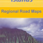 Hawaii – Kauai Nelles
 Lake Constance to Verona – E5 European Long-Distance Trail Kompass 2558
Trans-Alpine Crossing – Tegernsee – Achensee – Zillertal – Sterzing Kompass 2556
Lake Constance to Verona – E5 European Long-Distance Trail Kompass 2558
Trans-Alpine Crossing – Tegernsee – Achensee – Zillertal – Sterzing Kompass 2556
 Garden Route & Route 62 Map Studio
 Bali Periplus Travel Map
 Austria: Freytag & Berndt Cycling Maps
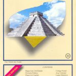
 Mexico: Ed. Independecia State Road Maps and Street Plans
 Mozart Bike Trail F&B RK3
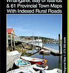 Northland: Whangarei, Bay of Islands and 61 Provincial Towns Pathfinder
 The Way of St. James to Compostela: Spanish Section
 Mรฉxico State – Toluca
 Michoacรกn State – Morelia
 Jalisco State – Guadalajara
 Coahuila State – Saltillo
 Hidalgo State – Pachuca
Nayarit State – Tepic
Sonora State – Hermosillo
Hidalgo State – Pachuca
Nayarit State – Tepic
Sonora State – Hermosillo
 Morelos State – Cuernavaca
 Tabasco State – Villahermosa
 Yucatan State – Mรฉrida
Rhine Cycle Route 4 – Cologne to Hoek van Holland Bikeline Map-Guide
Yucatan State – Mรฉrida
Rhine Cycle Route 4 – Cologne to Hoek van Holland Bikeline Map-Guide
 Rhine Cycle Route 3 – Mainz to Duisburg Bikeline Map-Guide
 Aguascalientes State – Aguascalientes City
Guanajuato State – Guanajuato City
Durango State – Durango City
Chihuahua State – Chihuahua City
Aguascalientes State – Aguascalientes City
Guanajuato State – Guanajuato City
Durango State – Durango City
Chihuahua State – Chihuahua City
 Tlaxcala State – Tlaxcala City
Zacatecas State – Zacatecas City
Colima State – Colima City
Tlaxcala State – Tlaxcala City
Zacatecas State – Zacatecas City
Colima State – Colima City
 Campeche State – Campeche City
 Oaxaca State – Oaxaca City
 Nuevo Lรฉon State – Monterrey
Sinaloa State – Culiacรกn – Mazatlan – Los Moches
Nuevo Lรฉon State – Monterrey
Sinaloa State – Culiacรกn – Mazatlan – Los Moches