Disclosure : This site contains affiliate links to products. We may receive a commission for purchases made through these links.
Sallandse Heuvelrug National Park: Deventer – Raalte – Rijssen
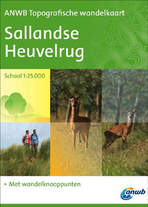
Sallandse Heuvelrug area of north Netherlands on a light, double-sided, waterproof and tear-resistant, GPS-compatible maps at 1:25,000 from ANWB, the country’s main motoring and touring organization, highlighting (where already established on the ground) the network of numbered junctions linking waymarked hiking trails, plus locations of TOPs (Tourist Transfer Points) where one can leave the car. Coverage extends from the town of Heino in the north-western corner to Markelo in the south-east, and west/east from the outskirts of Deventer to Rijssen.Maps in the series have contours at 2.5 or 5m intervals with spot heights, and show all the topographic features and landmarks expected of survey mapping at this scale. Unusually for a topographic survey, the maps also have colouring and/or graphics to show 14 different types of vegetation or land use (heath, dunes, marshland, orchards, arable land, etc). Where already established on the ground, an overprint highlights the national network of numbered junctions joined by waymarked connecting trails in either direction – a system which enables hikers to plan their own routes. Also marked are locations of TOPs where one can leave the car. Each map covers an area of approx. 12 x 26kms, with an overlap between the sides. The maps have the lines of the Dutch National Grid at intervals of 1km. Map legend, with an extensive list of the various topographic features and landmarks, includes English. To see the list of titles already published in this series please click on the series link.

Related Products:
 Netherlands: ANWB 25K Topographic Survey Hiking Maps
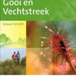 Gooi & Vechtstreek: Hilversum – Amersfoort – Utrecht
 Sallandse Heuvelrug
 Bavarian Forest National Park – Nature Park East UK50-29
 Grand Canyon National Park East AZ
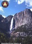
 Yosemite National Park
 Picos de Europa National Park 2-Map Set Editorial Alpina
 Richtersveld National Park and Northern Namaqualand
 Monti Sibillini National Park 6-Map Set
 Shivapuri Nagarjun National Park
 Death Valley National Park
 Skaftafell National Park IDNU Map
 Kruger National Park
 Grasslands National Park: East Block, Saskatchewan
 Banff National Park Gem Trek
 Aigรผestortes and Estany de Sant Maurici National Park 2-Map Set Editorial Alpina
 Sierra de Guadarrama National Park 4-Map and Guide Set CNIG
 Lassen Volcanic National Park, CA
 Khumbu – Sagarmatha National Park
 Sareks National Park Lantmateriet BD10
 รcrins Massif National Park Didier Richard 05
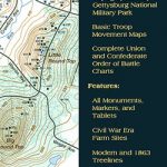 Gettysburg National Miltary Park
 Kootenay National Park Gem Trek Map
 Osogovski National Park
 Triglav National Park Kartografija WATERPROOF Hiking Map
 Grand Canyon National Park West AZ
Great Smoky Mountains National Park, NC/TN
Grand Canyon National Park West AZ
Great Smoky Mountains National Park, NC/TN
 Paklenica National Park Croatian Mountain Rescue Service 25K Map
 Lake District National Park Aerial Map
 Yosemite National Park Area
 Drawienski (Drawno) National Park
 Folgefonna National Park Nordeca 2663
 Vanoise National Park – Beaufortain Didier Richard 04
Puszcza Kampinoska – Kampinoski National Park
Bialowieza / Puszcza Bialowieska National Park
Vanoise National Park – Beaufortain Didier Richard 04
Puszcza Kampinoska – Kampinoski National Park
Bialowieza / Puszcza Bialowieska National Park
 Domodossola – Val Grande National Park Swisstopo Hiking 285T
 Los Glaciares National Park
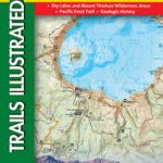 Crater Lake National Park OR NGS Trails Illustrated Map 244
 Channel Islands National Park CA NGS Trails Illustrated Map 252
 North Fork – Glacier National Park MT NGS Trails Illustrated Map 313