Disclosure : This site contains affiliate links to products. We may receive a commission for purchases made through these links.
Salla – Savukoski Recreational Map
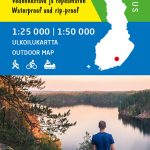
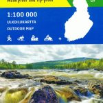
Salla – Savukoski area of Finland at 1:100,000 in a series of beautiful and informative maps of popular outdoor leisure areas with cartography of the country’s topographic survey. Excellent use of colours, shading and symbols provides a very detailed picture of the terrain and vegetation. Extensive overprint highlights routes for hiking, and/or other outdoor pursuits, a wide variety of accommodation, from hotels and holiday villages to Lapland tepees, food and fuel supplies, etc. The maps have a UTM grid and margin ticks for latitude and longitude. Map legends include English. IN THIS TITLE: hiking, skiing and canoeing map of the Sevettijรคrvi – Nuorgam area in the northern tip of Finland. Contours are at 10m intervals, with relief shading and colouring/symbols indicating different types of terrain and vegetation. An overprint highlights hiking trails, ski routes, and canoeing routes, as well as various types of accommodation (hotels, holiday camps, campsites, huts, etc.), restaurants and shopping facilities, petrol stations, etc. The map has a UTM grid, with latitude and longitude lines at 5’ intervals. Map legend includes English.

Related Products:
 Lemmenjoki National Park
 Utsjoki – Kevo Nature Reserve
 Yllรคs Levi
 Repovesi – Mรคntyharju Karttakeskus Outdoor Map
 Helvetinjรคrvi – Seitseminen
 Evo Pรคijรคnne Ilvesvaellus
 Kuusamo Karttakeskus Outdoor Map
 Nuuksio Luukki Karttakeskus Outdoor Map
 Hammastunturi – South Inari
 Pallas – Hetta – Olos
 Nunnanen – Kalmakaltio – Suukisjoki
 Ropi – Kalkkoaivi – Munnikurkkio
 Muotkatunturit
 Teijo
Teijo
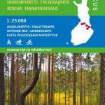
 Tuntsa – Tulppio – Sorsatunturi Karttakeskus Topo Map
Pyhรค – Luosto Karttakeskus Outdoor Map
Saariselkรค – Sokosti Karttakeskus Outdoor Map
Tuntsa – Tulppio – Sorsatunturi Karttakeskus Topo Map
Pyhรค – Luosto Karttakeskus Outdoor Map
Saariselkรค – Sokosti Karttakeskus Outdoor Map
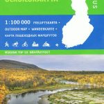 Sevettijรคrvi – Nuorgam
 Pรถyrisjรคrvi – Kalmakaltio – Hetta Karttakeskus Topo Map
Finland: Karttakeskus Topographic Hiking Maps
Suwalki Region ExpressMap Tourist Map
Koli – Ruunaa – Patvinsuo – Petkeljรคrvi Karttakeskus Outdoor Map
Pรถyrisjรคrvi – Kalmakaltio – Hetta Karttakeskus Topo Map
Finland: Karttakeskus Topographic Hiking Maps
Suwalki Region ExpressMap Tourist Map
Koli – Ruunaa – Patvinsuo – Petkeljรคrvi Karttakeskus Outdoor Map
 Vuokatti – Kainuu National Park
 Gรณry Stolowe ExpressMap Tourist Map
Warsaw Environs ExpressMap Tourist Map
Gรณry Stolowe ExpressMap Tourist Map
Warsaw Environs ExpressMap Tourist Map
 Lithuania: Briedis 50K Recreational Maps
Mazury Lake District – Southern Part ExpressMap Tourist Map
Nadmorski Regional Park – Hel Peninsula ExpressMap Tourist Map
Lithuania: Briedis 50K Recreational Maps
Mazury Lake District – Southern Part ExpressMap Tourist Map
Nadmorski Regional Park – Hel Peninsula ExpressMap Tourist Map
 Beskid Niski ExpressMap Tourist Map
 Beskid Wyspowy ExpressMap Tourist Map
 Swietokrzyskie Mountains ExpressMap Tourist Map
Krakรณw Environs ExpressMap Tourist Map
Mazury Lake District – Northern Part ExpressMap Tourist Map
Klodzko Environs ExpressMap Tourist Map
Kampinoska Forest ExpressMap Tourist Map
Swietokrzyskie Mountains ExpressMap Tourist Map
Krakรณw Environs ExpressMap Tourist Map
Mazury Lake District – Northern Part ExpressMap Tourist Map
Klodzko Environs ExpressMap Tourist Map
Kampinoska Forest ExpressMap Tourist Map
 Kaszuby – Kashubian Landscape Park ExpressMap Tourist Map
 Ripollรจs Editorial Alpina
 Beskid Maly i Makowski ExpressMap Tourist Map
 Puigmal – Vall de Nuria – Ulldeter Editorial Alpina
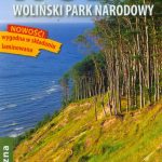 Wolin Island – Wolinski National Park ExpressMap Tourist Map