Disclosure : This site contains affiliate links to products. We may receive a commission for purchases made through these links.
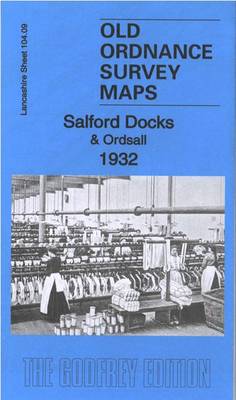
Salford Docks & Ordsall 1932 – 104.09c
Related Products:
 Salford Docks 1905
 Salford Docks 1916
 Salford (West) & Pendleton 1931 – 104.05c
 Manchester (NW) & Central Salford 1931 – 104.06c
 Newport Docks 1920
 Southampton Docks 1931 – 65.15b
 Speke & Garston Docks 1890 – 113.16a
 Manchester (SW) 1932 – 104.10c
 Moss Side 1932 – 104.14c
 Southampton (East) 1932 – 65.11b
 Southampton (Portswood & Highfield) 1932 – 65.03
 Southampton NE (Bevois Town & Bitterne) 1932 – 65.07
 Salford Adelphi 1848
 Manchester North West and Central Salford 1915
 Manchester & Salford – Oldham, Rochdale & Stockport OS Explorer Map 277 (paper)
 Manchester & Salford – Oldham, Rochdale & Stockport OS Explorer Active Map 277 (waterproof)
 Bootle Docks & Seaforth 1907 – 99.13
 West India Docks 1867 – 79.1
 Bristol City Docks Through Time
 Admiralty Chart IN2001 – Mumbai Docks
 Chadderton North 1932
 Manchester SE & Ardwick 1932 – 104.11b
 West India Docks & Greenwich Marshes 1894 – 79.2
 Liverpool Pierhead (Prince`s and George`s Docks) 1864
 The Medway Towns: Rover, Docks And Urban Life
 North Surbiton and South Kingston 1932
 Lovers at the Chameleon Club, Paris 1932: A Novel
 Henri Cartier-Bresson: Photographs 1932-1946
 Admiralty Chart IN3006 – Hugli River, Kukrahatti Reach to Kolkata Docks
 Stanford`s Chart of the Solent, Spithead and Southampton Water (1932) – A2 Wall Map, Canvas
 Stanford`s Chart of the Solent, Spithead and Southampton Water (1932) – A1 Wall Map, Canvas
 Stanford`s Chart of the Solent, Spithead and Southampton Water (1932) – A3 Wall Map, Paper – Print on Demand
 Stanford`s Chart of the Solent, Spithead and Southampton Water (1932) – A3 Wall Map, Canvas – Print on Demand
 Stanford`s Chart of the Solent, Spithead and Southampton Water (1932) – A2 Wall Map, Paper – Print on Demand
 Stanford`s Chart of the Solent, Spithead and Southampton Water (1932) – A1 Wall Map, Paper – Print on Demand
 Stanford`s Chart of the Solent, Spithead and Southampton Water (1932) – Original Size Wall Map, Canvas
 Stanford`s Chart of the Solent, Spithead and Southampton Water (1932) – Original Size Wall Map, Paper – Print on Demand
 London`s Waterside Walks: 21 Walks Along the City`s Most Interesting Rivers, Canals & Docks


